

Alternate Bike Route #2
A cycling route starting in Portland, Connecticut, United States.
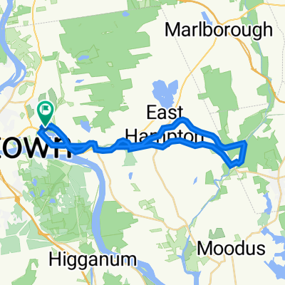
Overview
About this route
Family-friendly bike route that uses side streets west and east of Main Street, crossing at crosswalks at street lights.
- -:--
- Duration
- 6 km
- Distance
- 74 m
- Ascent
- 71 m
- Descent
- ---
- Avg. speed
- ---
- Max. altitude

Route quality
Waytypes & surfaces along the route
Waytypes
Quiet road
4.9 km
(81 %)
Pedestrian area
0.1 km
(1 %)
Undefined
1.1 km
(18 %)
Surfaces
Paved
4.7 km
(77 %)
Asphalt
4.7 km
(77 %)
Undefined
1.4 km
(23 %)
Continue with Bikemap
Use, edit, or download this cycling route
You would like to ride Alternate Bike Route #2 or customize it for your own trip? Here is what you can do with this Bikemap route:
Free features
- Save this route as favorite or in collections
- Copy & plan your own version of this route
- Sync your route with Garmin or Wahoo
Premium features
Free trial for 3 days, or one-time payment. More about Bikemap Premium.
- Navigate this route on iOS & Android
- Export a GPX / KML file of this route
- Create your custom printout (try it for free)
- Download this route for offline navigation
Discover more Premium features.
Get Bikemap PremiumFrom our community
Other popular routes starting in Portland
 Airline Trail Metric Century
- Distance
- 100.5 km
- Ascent
- 485 m
- Descent
- 485 m
- Location
- Portland, Connecticut, United States
 Metric Century - Airline
- Distance
- 102.6 km
- Ascent
- 403 m
- Descent
- 403 m
- Location
- Portland, Connecticut, United States
 Airline - Hop River Metric Century
- Distance
- 92.2 km
- Ascent
- 361 m
- Descent
- 397 m
- Location
- Portland, Connecticut, United States
 245 Marlborough St, Portland to 100 Dudley Ave, Old Saybrook
- Distance
- 47.7 km
- Ascent
- 572 m
- Descent
- 593 m
- Location
- Portland, Connecticut, United States
 Slow ride in Portland
- Distance
- 7.6 km
- Ascent
- 101 m
- Descent
- 99 m
- Location
- Portland, Connecticut, United States
 Route to 26 Mansfield Terr, Middletown
- Distance
- 10.6 km
- Ascent
- 124 m
- Descent
- 127 m
- Location
- Portland, Connecticut, United States
 Route to 74 Middle Haddam Rd, Portland
- Distance
- 9.2 km
- Ascent
- 194 m
- Descent
- 193 m
- Location
- Portland, Connecticut, United States
 East Hampton CT
- Distance
- 33.8 km
- Ascent
- 561 m
- Descent
- 563 m
- Location
- Portland, Connecticut, United States
Open it in the app