

🚴🏼♂️ Katowice ➡️ Dolina Trzech Stawów / Muchowiec 🏆
A cycling route starting in Katowice, Silesian Voivodeship, Poland.
Overview
About this route
Trzy Stawy, Muchowiec
🚴🏼♂️🚴🏼♂️ Find more interesting routes from Katowice by clicking on my profile
- -:--
- Duration
- 13.2 km
- Distance
- 39 m
- Ascent
- 39 m
- Descent
- ---
- Avg. speed
- ---
- Max. altitude

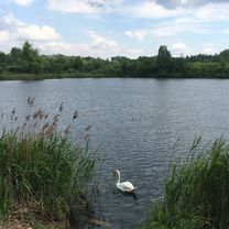
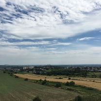
Route photos


Route quality
Waytypes & surfaces along the route
Waytypes
Path
6 km
(45 %)
Pedestrian area
3.2 km
(24 %)
Surfaces
Paved
6.7 km
(51 %)
Unpaved
0.4 km
(3 %)
Asphalt
6.4 km
(48 %)
Ground
0.4 km
(3 %)
Route highlights
Points of interest along the route

Point of interest after 8.6 km

Point of interest after 9.7 km
Continue with Bikemap
Use, edit, or download this cycling route
You would like to ride 🚴🏼♂️ Katowice ➡️ Dolina Trzech Stawów / Muchowiec 🏆 or customize it for your own trip? Here is what you can do with this Bikemap route:
Free features
- Save this route as favorite or in collections
- Copy & plan your own version of this route
- Sync your route with Garmin or Wahoo
Premium features
Free trial for 3 days, or one-time payment. More about Bikemap Premium.
- Navigate this route on iOS & Android
- Export a GPX / KML file of this route
- Create your custom printout (try it for free)
- Download this route for offline navigation
Discover more Premium features.
Get Bikemap PremiumFrom our community
Other popular routes starting in Katowice
 Katowice-Będzin zamek
- Distance
- 49 km
- Ascent
- 234 m
- Descent
- 234 m
- Location
- Katowice, Silesian Voivodeship, Poland
 katowice jaworzno zb. grodek
- Distance
- 57.7 km
- Ascent
- 157 m
- Descent
- 157 m
- Location
- Katowice, Silesian Voivodeship, Poland
 dwie hołdy
- Distance
- 64.6 km
- Ascent
- 380 m
- Descent
- 382 m
- Location
- Katowice, Silesian Voivodeship, Poland
 Koszutka - Paprocany
- Distance
- 38.1 km
- Ascent
- 148 m
- Descent
- 173 m
- Location
- Katowice, Silesian Voivodeship, Poland
 🚴🏼♂️ Katowice ➡️ Świerklaniec / przez Żabie Doły 🏆
- Distance
- 56 km
- Ascent
- 235 m
- Descent
- 237 m
- Location
- Katowice, Silesian Voivodeship, Poland
 🚴🏼♂️ Katowice ➡️ Kopiec Wyzwolenia / Piekary Śląskie - punkt widokowy 🏆
- Distance
- 41.9 km
- Ascent
- 231 m
- Descent
- 231 m
- Location
- Katowice, Silesian Voivodeship, Poland
 Katowice - Mysłowice Słupna
- Distance
- 46.7 km
- Ascent
- 229 m
- Descent
- 229 m
- Location
- Katowice, Silesian Voivodeship, Poland
 🚴🏼♂️ Katowice ➡️ Dziećkowice /przez las Murckowski
- Distance
- 64 km
- Ascent
- 263 m
- Descent
- 263 m
- Location
- Katowice, Silesian Voivodeship, Poland
Open it in the app