

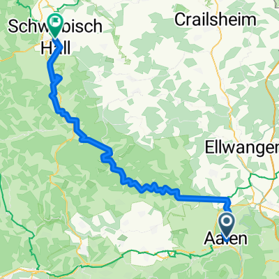
Kochertal Aalen - Schwäbisch Hall - Bad Friedrichsau Tag 1
A cycling route starting in Aalen, Baden-Wurttemberg, Germany.
Overview
About this route
- -:--
- Duration
- 73.3 km
- Distance
- 205 m
- Ascent
- 369 m
- Descent
- ---
- Avg. speed
- ---
- Max. altitude

Route highlights
Points of interest along the route

Photo after 0.5 km
Kocher-Jagst-Radweg

Photo after 54.6 km
Martinskirche von Westheim
Continue with Bikemap
Use, edit, or download this cycling route
You would like to ride Kochertal Aalen - Schwäbisch Hall - Bad Friedrichsau Tag 1 or customize it for your own trip? Here is what you can do with this Bikemap route:
Free features
- Save this route as favorite or in collections
- Copy & plan your own version of this route
- Sync your route with Garmin or Wahoo
Premium features
Free trial for 3 days, or one-time payment. More about Bikemap Premium.
- Navigate this route on iOS & Android
- Export a GPX / KML file of this route
- Create your custom printout (try it for free)
- Download this route for offline navigation
Discover more Premium features.
Get Bikemap PremiumFrom our community
Other popular routes starting in Aalen
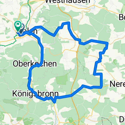
 Aalen - Schwäbisch Hall 67km
- Distance
- 67.3 km
- Ascent
- 981 m
- Descent
- 1,104 m
- Location
- Aalen, Baden-Wurttemberg, Germany
 Kocher-Jagst-Radweg
- Distance
- 338.1 km
- Ascent
- 4,732 m
- Descent
- 4,733 m
- Location
- Aalen, Baden-Wurttemberg, Germany
 Runde um Neuler
- Distance
- 45.8 km
- Ascent
- 792 m
- Descent
- 770 m
- Location
- Aalen, Baden-Wurttemberg, Germany
 Kochertal Aalen - Schwäbisch Hall - Bad Friedrichsau Tag 1
- Distance
- 73.3 km
- Ascent
- 205 m
- Descent
- 369 m
- Location
- Aalen, Baden-Wurttemberg, Germany
 Härtsfeldrunde
- Distance
- 62.3 km
- Ascent
- 596 m
- Descent
- 533 m
- Location
- Aalen, Baden-Wurttemberg, Germany
 Braunen Berg - Ipf - Baldern - Kapfenburg
- Distance
- 53.6 km
- Ascent
- 834 m
- Descent
- 834 m
- Location
- Aalen, Baden-Wurttemberg, Germany
 Favourite Tracks IV
- Distance
- 19.6 km
- Ascent
- 450 m
- Descent
- 402 m
- Location
- Aalen, Baden-Wurttemberg, Germany
 Remstalradroute
- Distance
- 72.6 km
- Ascent
- 3,847 m
- Descent
- 4,276 m
- Location
- Aalen, Baden-Wurttemberg, Germany
Open it in the app