

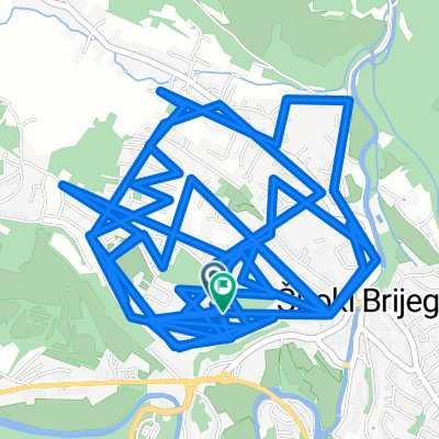
L105 – Široki Brijeg – Uzarići - Podgorje – Miljkovići- Knešpolje - Široki Brijeg
A cycling route starting in Široki Brijeg, Federation of Bosnia and Herzegovina, Bosnia and Herzegovina.
Overview
About this route
- -:--
- Duration
- 42.6 km
- Distance
- 393 m
- Ascent
- 390 m
- Descent
- ---
- Avg. speed
- ---
- Max. altitude

Route quality
Waytypes & surfaces along the route
Waytypes
Quiet road
6.4 km
(15 %)
Road
2.6 km
(6 %)
Surfaces
Paved
34.5 km
(81 %)
Unpaved
0.4 km
(1 %)
Asphalt
34.1 km
(80 %)
Paved (undefined)
0.4 km
(1 %)
Continue with Bikemap
Use, edit, or download this cycling route
You would like to ride L105 – Široki Brijeg – Uzarići - Podgorje – Miljkovići- Knešpolje - Široki Brijeg or customize it for your own trip? Here is what you can do with this Bikemap route:
Free features
- Save this route as favorite or in collections
- Copy & plan your own version of this route
- Sync your route with Garmin or Wahoo
Premium features
Free trial for 3 days, or one-time payment. More about Bikemap Premium.
- Navigate this route on iOS & Android
- Export a GPX / KML file of this route
- Create your custom printout (try it for free)
- Download this route for offline navigation
Discover more Premium features.
Get Bikemap PremiumFrom our community
Other popular routes starting in Široki Brijeg
 Steady ride
- Distance
- 20.7 km
- Ascent
- 254 m
- Descent
- 298 m
- Location
- Široki Brijeg, Federation of Bosnia and Herzegovina, Bosnia and Herzegovina
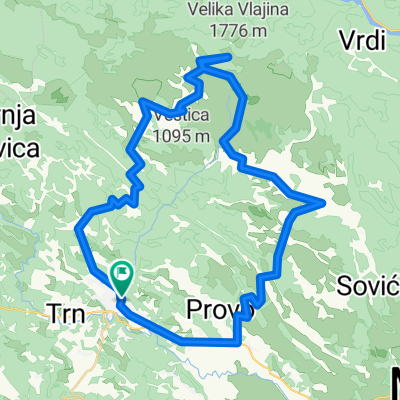 Š.B. - ČABULJA -Š.B.
- Distance
- 59.6 km
- Ascent
- 1,590 m
- Descent
- 1,588 m
- Location
- Široki Brijeg, Federation of Bosnia and Herzegovina, Bosnia and Herzegovina
 L105 – Široki Brijeg – Uzarići - Podgorje – Miljkovići- Knešpolje - Široki Brijeg
- Distance
- 42.6 km
- Ascent
- 393 m
- Descent
- 390 m
- Location
- Široki Brijeg, Federation of Bosnia and Herzegovina, Bosnia and Herzegovina
 Franciskana MTB
- Distance
- 377.7 km
- Ascent
- 5,216 m
- Descent
- 5,217 m
- Location
- Široki Brijeg, Federation of Bosnia and Herzegovina, Bosnia and Herzegovina
 Herzegovina MTB
- Distance
- 128.3 km
- Ascent
- 1,700 m
- Descent
- 1,698 m
- Location
- Široki Brijeg, Federation of Bosnia and Herzegovina, Bosnia and Herzegovina
 Široki - Klobuk (kroz sela) - Široki
- Distance
- 43.5 km
- Ascent
- 538 m
- Descent
- 545 m
- Location
- Široki Brijeg, Federation of Bosnia and Herzegovina, Bosnia and Herzegovina
 Franciskana Cestovna
- Distance
- 457.5 km
- Ascent
- 6,271 m
- Descent
- 6,275 m
- Location
- Široki Brijeg, Federation of Bosnia and Herzegovina, Bosnia and Herzegovina
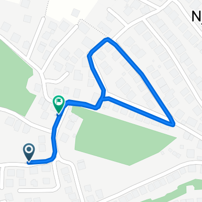 Restful route
- Distance
- 1.2 km
- Ascent
- 3 m
- Descent
- 56 m
- Location
- Široki Brijeg, Federation of Bosnia and Herzegovina, Bosnia and Herzegovina
Open it in the app