

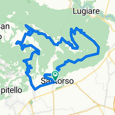
da Santorso a Posina
A cycling route starting in Santorso, Veneto, Italy.
Overview
About this route
Piovene Rocchette, poi la ciclabile sulla sede ferroviaria fino ad Arsiero, poi la stradina che costeggia il Posina, fino a Posina. Gnocchi all'Alpino, poi salita al colle Xomo (1050 m) e lunga discesa fino a S. Caterina, Poleo, Schio e arrivo a Santorso.
- -:--
- Duration
- 55.6 km
- Distance
- 1,189 m
- Ascent
- 932 m
- Descent
- ---
- Avg. speed
- ---
- Max. altitude

Route quality
Waytypes & surfaces along the route
Waytypes
Quiet road
20.1 km
(36 %)
Road
14.8 km
(27 %)
Surfaces
Paved
25.1 km
(45 %)
Unpaved
11.4 km
(20 %)
Asphalt
24 km
(43 %)
Gravel
6.4 km
(12 %)
Continue with Bikemap
Use, edit, or download this cycling route
You would like to ride da Santorso a Posina or customize it for your own trip? Here is what you can do with this Bikemap route:
Free features
- Save this route as favorite or in collections
- Copy & plan your own version of this route
- Sync your route with Garmin or Wahoo
Premium features
Free trial for 3 days, or one-time payment. More about Bikemap Premium.
- Navigate this route on iOS & Android
- Export a GPX / KML file of this route
- Create your custom printout (try it for free)
- Download this route for offline navigation
Discover more Premium features.
Get Bikemap PremiumFrom our community
Other popular routes starting in Santorso
 Da Via della Ravizza, Santorso a Vicolo Alessandro Maganza 13/A, Santorso
- Distance
- 17.7 km
- Ascent
- 662 m
- Descent
- 666 m
- Location
- Santorso, Veneto, Italy
 Giro Summano
- Distance
- 26.4 km
- Ascent
- 1,151 m
- Descent
- 1,151 m
- Location
- Santorso, Veneto, Italy
 2017-da Santorso al Passo Xomo
- Distance
- 53 km
- Ascent
- 981 m
- Descent
- 981 m
- Location
- Santorso, Veneto, Italy
 da Santorso a Posina
- Distance
- 55.6 km
- Ascent
- 1,189 m
- Descent
- 932 m
- Location
- Santorso, Veneto, Italy
 Santorso schio
- Distance
- 17.1 km
- Ascent
- 97 m
- Descent
- 97 m
- Location
- Santorso, Veneto, Italy
 Sumano
- Distance
- 10.7 km
- Ascent
- 0 m
- Descent
- 1,055 m
- Location
- Santorso, Veneto, Italy
 Novegno Brazome Renzo Trail on AllTrails
- Distance
- 32.6 km
- Ascent
- 1,498 m
- Descent
- 1,497 m
- Location
- Santorso, Veneto, Italy
 Santorso Bosco di Tretto - S. Caterina - Schio -Santorso
- Distance
- 25.9 km
- Ascent
- 752 m
- Descent
- 752 m
- Location
- Santorso, Veneto, Italy
Open it in the app