

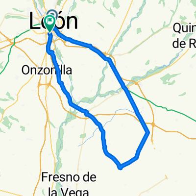
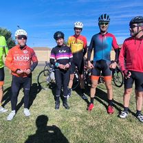
SAN MIGUEL DE LA ESCALADA
A cycling route starting in León, Castille and León, Spain.
Overview
About this route
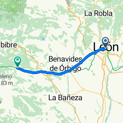
LEÓN-PUENTE VILLARENTE-MELLANZOS-CASASOLA-RUEDA-SAN MIGUEL DE LA ESCALADA-MANSILLA-VILLARROAÑE-SANTA OLAJA DE LA RIBERA-LEÓN
- -:--
- Duration
- 73.9 km
- Distance
- 291 m
- Ascent
- 292 m
- Descent
- ---
- Avg. speed
- ---
- Max. altitude
Route quality
Waytypes & surfaces along the route
Waytypes
Road
27.3 km
(37 %)
Quiet road
10.3 km
(14 %)
Surfaces
Paved
56.9 km
(77 %)
Unpaved
1.5 km
(2 %)
Asphalt
56.9 km
(77 %)
Gravel
1.5 km
(2 %)
Undefined
15.5 km
(21 %)
Continue with Bikemap
Use, edit, or download this cycling route
You would like to ride SAN MIGUEL DE LA ESCALADA or customize it for your own trip? Here is what you can do with this Bikemap route:
Free features
- Save this route as favorite or in collections
- Copy & plan your own version of this route
- Sync your route with Garmin or Wahoo
Premium features
Free trial for 3 days, or one-time payment. More about Bikemap Premium.
- Navigate this route on iOS & Android
- Export a GPX / KML file of this route
- Create your custom printout (try it for free)
- Download this route for offline navigation
Discover more Premium features.
Get Bikemap PremiumFrom our community
Other popular routes starting in León
 PTE.CASTRO-MANSILLA-STAS. MARTAS-GUSENDOS-CORBILLOS-PALANQUINOS-VEGA DE INFANZONES
- Distance
- 64.4 km
- Ascent
- 210 m
- Descent
- 220 m
- Location
- León, Castille and León, Spain
 LEON-S.ANDRES-MONTEJOS-CARRIZO-RIOFRIO-PALAZUELO-BENAVIDES-STA.MARINA REY-VILLADANGOS-LA
- Distance
- 77.4 km
- Ascent
- 400 m
- Descent
- 405 m
- Location
- León, Castille and León, Spain
 74 km. ruta de las Omañas
- Distance
- 74.4 km
- Ascent
- 632 m
- Descent
- 694 m
- Location
- León, Castille and León, Spain
 De Calle la Gaviota a Travesía General Gutiérrez Mellado
- Distance
- 79.7 km
- Ascent
- 697 m
- Descent
- 759 m
- Location
- León, Castille and León, Spain
 2025. 3 nap El Camino
- Distance
- 75.2 km
- Ascent
- 635 m
- Descent
- 326 m
- Location
- León, Castille and León, Spain
 León-Villaverde de arriba-León
- Distance
- 35.9 km
- Ascent
- 227 m
- Descent
- 227 m
- Location
- León, Castille and León, Spain
 70 km. ruta de Valdesogo, Mansilla
- Distance
- 70.9 km
- Ascent
- 384 m
- Descent
- 427 m
- Location
- León, Castille and León, Spain
 BHC D01 León - Astorga 60 km
- Distance
- 74.2 km
- Ascent
- 710 m
- Descent
- 402 m
- Location
- León, Castille and León, Spain
Open it in the app