

Big Duckie
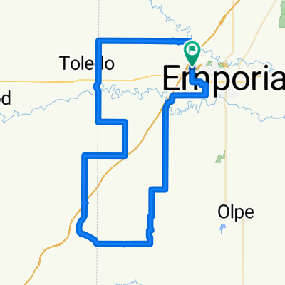
A cycling route starting in Emporia, Kansas, United States.
Overview
About this route
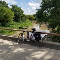
52 mile loop SW of Emporia. Mainly gravel, this route uses some very-low-traffic roads and may require crossing onto private road.
- -:--
- Duration
- 84 km
- Distance
- 270 m
- Ascent
- 272 m
- Descent
- ---
- Avg. speed
- ---
- Max. altitude

Route quality
Waytypes & surfaces along the route
Waytypes
Quiet road
42 km
(50 %)
Road
39.5 km
(47 %)
Surfaces
Paved
9.2 km
(11 %)
Unpaved
68 km
(81 %)
Unpaved (undefined)
58.8 km
(70 %)
Paved (undefined)
9.2 km
(11 %)
Continue with Bikemap
Use, edit, or download this cycling route
You would like to ride Big Duckie or customize it for your own trip? Here is what you can do with this Bikemap route:
Free features
- Save this route as favorite or in collections
- Copy & plan your own version of this route
- Split it into stages to create a multi-day tour
- Sync your route with Garmin or Wahoo
Premium features
Free trial for 3 days, or one-time payment. More about Bikemap Premium.
- Navigate this route on iOS & Android
- Export a GPX / KML file of this route
- Create your custom printout (try it for free)
- Download this route for offline navigation
Discover more Premium features.
Get Bikemap PremiumFrom our community
Other popular routes starting in Emporia
 1416 Presby Dr, Emporia to 1416 Presby Dr, Emporia
- Distance
- 14 km
- Ascent
- 46 m
- Descent
- 50 m
- Location
- Emporia, Kansas, United States
 gpxTitleOfFile
- Distance
- 6.2 km
- Ascent
- 23 m
- Descent
- 39 m
- Location
- Emporia, Kansas, United States
 2021 UNBOUND 25
- Distance
- 43.7 km
- Ascent
- 159 m
- Descent
- 156 m
- Location
- Emporia, Kansas, United States
 Southwestern loop 35
- Distance
- 50.4 km
- Ascent
- 258 m
- Descent
- 270 m
- Location
- Emporia, Kansas, United States
 Teapot Mound Loop
- Distance
- 79.4 km
- Ascent
- 268 m
- Descent
- 267 m
- Location
- Emporia, Kansas, United States
 DIrty Kanza 25 mile route 2019
- Distance
- 43.7 km
- Ascent
- 88 m
- Descent
- 89 m
- Location
- Emporia, Kansas, United States
 Big Duckie
- Distance
- 84 km
- Ascent
- 270 m
- Descent
- 272 m
- Location
- Emporia, Kansas, United States
 County Seat Run
- Distance
- 43.6 km
- Ascent
- 115 m
- Descent
- 115 m
- Location
- Emporia, Kansas, United States
Open it in the app