MazanMazan
A cycling route starting in Mazan, Provence-Alpes-C么te d'Azur Region, France.
Overview
About this route
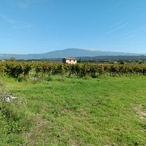
Beautiful ride from Mazan featuring the stunning col de Ligne and col de Murs. Along the route, you pass through the following villages: Mazan, Mormoiron, Villes-sur-Auzon, M茅thamis, Murs, Venasque, Malemort-de-Comtat.
- 4 h 22 min
- Duration
- 61.4 km
- Distance
- 1,504 m
- Ascent
- 1,508 m
- Descent
- 14.1 km/h
- Avg. speed
- ---
- Max. altitude
Route quality
Waytypes & surfaces along the route
Waytypes
Road
28.3 km
(46 %)
Quiet road
16.6 km
(27 %)
Undefined
16.6 km
(27 %)
Surfaces
Paved
40.5 km
(66 %)
Asphalt
40.5 km
(66 %)
Undefined
20.9 km
(34 %)
Continue with Bikemap
Use, edit, or download this cycling route
You would like to ride MazanMazan or customize it for your own trip? Here is what you can do with this Bikemap route:
Free features
- Save this route as favorite or in collections
- Copy & plan your own version of this route
- Sync your route with Garmin or Wahoo
Premium features
Free trial for 3 days, or one-time payment. More about Bikemap Premium.
- Navigate this route on iOS & Android
- Export a GPX / KML file of this route
- Create your custom printout (try it for free)
- Download this route for offline navigation
Discover more Premium features.
Get Bikemap PremiumFrom our community
Other popular routes starting in Mazan
- Le tour du Ventoux 103km
- Distance
- 103 km
- Ascent
- 1,055 m
- Descent
- 1,065 m
- Location
- Mazan, Provence-Alpes-C么te d'Azur Region, France
- Provence_2020_2: Gorges de la Nesque
- Distance
- 79.6 km
- Ascent
- 886 m
- Descent
- 888 m
- Location
- Mazan, Provence-Alpes-C么te d'Azur Region, France
- tour dentelles de montmirail
- Distance
- 80.8 km
- Ascent
- 982 m
- Descent
- 979 m
- Location
- Mazan, Provence-Alpes-C么te d'Azur Region, France
- Mazan a vinice na sever
- Distance
- 39.6 km
- Ascent
- 407 m
- Descent
- 418 m
- Location
- Mazan, Provence-Alpes-C么te d'Azur Region, France
- Mazan to Il de sur kolecko
- Distance
- 46.6 km
- Ascent
- 410 m
- Descent
- 405 m
- Location
- Mazan, Provence-Alpes-C么te d'Azur Region, France
- Etapa 6: A Baux du Provence
- Distance
- 102.8 km
- Ascent
- 1,047 m
- Descent
- 996 m
- Location
- Mazan, Provence-Alpes-C么te d'Azur Region, France
- 6-MAZAN-GORGES DE LA NESQUE
- Distance
- 69.8 km
- Ascent
- 1,196 m
- Descent
- 1,199 m
- Location
- Mazan, Provence-Alpes-C么te d'Azur Region, France
- Fabians M枚rderroute
- Distance
- 160.6 km
- Ascent
- 4,335 m
- Descent
- 4,335 m
- Location
- Mazan, Provence-Alpes-C么te d'Azur Region, France
Open it in the app