

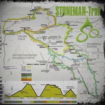
Dolomiten
Stoneman Dolomiti Tag 3 by mnh
A cycling route starting in Comelico Superiore, Veneto, Italy.
Overview
About this route
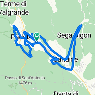
Von Padola über den Kreuzbergpass zur Rotwandwiesen-Station (Checkpoint 5).
Abfahrt nach Sexten - Sesto.
- -:--
- Duration
- 20.9 km
- Distance
- 769 m
- Ascent
- 671 m
- Descent
- ---
- Avg. speed
- ---
- Max. altitude

Part of
Dolomiten
3 stages
Route quality
Waytypes & surfaces along the route
Waytypes
Track
14.4 km
(69 %)
Quiet road
4.4 km
(21 %)
Surfaces
Paved
1.9 km
(9 %)
Unpaved
14.4 km
(69 %)
Gravel
9.4 km
(45 %)
Unpaved (undefined)
5 km
(24 %)
Continue with Bikemap
Use, edit, or download this cycling route
You would like to ride Stoneman Dolomiti Tag 3 by mnh or customize it for your own trip? Here is what you can do with this Bikemap route:
Free features
- Save this route as favorite or in collections
- Copy & plan your own version of this route
- Sync your route with Garmin or Wahoo
Premium features
Free trial for 3 days, or one-time payment. More about Bikemap Premium.
- Navigate this route on iOS & Android
- Export a GPX / KML file of this route
- Create your custom printout (try it for free)
- Download this route for offline navigation
Discover more Premium features.
Get Bikemap PremiumFrom our community
Other popular routes starting in Comelico Superiore
 Costa della Spina
- Distance
- 34.6 km
- Ascent
- 1,290 m
- Descent
- 1,290 m
- Location
- Comelico Superiore, Veneto, Italy
 Malghe e Rifugi Alta Val Pusteria da Padola @rb
- Distance
- 45.7 km
- Ascent
- 1,568 m
- Descent
- 1,558 m
- Location
- Comelico Superiore, Veneto, Italy
 Cima dei Colesei
- Distance
- 23.5 km
- Ascent
- 864 m
- Descent
- 864 m
- Location
- Comelico Superiore, Veneto, Italy
 Stoneman Dolomiti Tag 3 by mnh
- Distance
- 20.9 km
- Ascent
- 769 m
- Descent
- 671 m
- Location
- Comelico Superiore, Veneto, Italy
 giro Padola
- Distance
- 40.1 km
- Ascent
- 1,156 m
- Descent
- 1,155 m
- Location
- Comelico Superiore, Veneto, Italy
 Borghi e Troi
- Distance
- 22.6 km
- Ascent
- 754 m
- Descent
- 765 m
- Location
- Comelico Superiore, Veneto, Italy
 3.dan Dolomiti
- Distance
- 123.4 km
- Ascent
- 2,009 m
- Descent
- 2,870 m
- Location
- Comelico Superiore, Veneto, Italy
 stoneman dolomiti road / Start Padola
- Distance
- 188.2 km
- Ascent
- 5,729 m
- Descent
- 5,733 m
- Location
- Comelico Superiore, Veneto, Italy
Open it in the app