

Geocache Oberwaldberungen
A cycling route starting in Sondheim vor der Rhön, Bavaria, Germany.
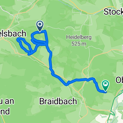
Overview
About this route
Geocache-Runde
- -:--
- Duration
- 22.8 km
- Distance
- 278 m
- Ascent
- 411 m
- Descent
- ---
- Avg. speed
- ---
- Max. altitude
Route quality
Waytypes & surfaces along the route
Waytypes
Track
12.6 km
(56 %)
Road
6.1 km
(27 %)
Surfaces
Paved
16.2 km
(71 %)
Unpaved
4.6 km
(20 %)
Asphalt
14.3 km
(63 %)
Gravel
4.6 km
(20 %)
Route highlights
Points of interest along the route
Point of interest after 1.7 km
Erste Rhöner Milchtankstelle
Point of interest after 3.4 km
Markus Thorandt
Point of interest after 3.6 km
Fabian Boll
Point of interest after 3.8 km
Gerald Asamoah
Point of interest after 4.1 km
Matthias Lehmann
Point of interest after 4.3 km
Charles Takyi
Point of interest after 5.1 km
Benedikt Pliquett
Point of interest after 5.4 km
Moritz Volz
Point of interest after 5.8 km
Fin Bartels
Point of interest after 6.3 km
Ralph Gunesch
Point of interest after 6.6 km
Carlos Zambrano
Point of interest after 7.1 km
Max Kruse
Point of interest after 10.5 km
Blickpunkt Strassenbau
Point of interest after 11.2 km
Foellenteich Oberwald
Point of interest after 12.3 km
Hotel Lebensraum
Continue with Bikemap
Use, edit, or download this cycling route
You would like to ride Geocache Oberwaldberungen or customize it for your own trip? Here is what you can do with this Bikemap route:
Free features
- Save this route as favorite or in collections
- Copy & plan your own version of this route
- Sync your route with Garmin or Wahoo
Premium features
Free trial for 3 days, or one-time payment. More about Bikemap Premium.
- Navigate this route on iOS & Android
- Export a GPX / KML file of this route
- Create your custom printout (try it for free)
- Download this route for offline navigation
Discover more Premium features.
Get Bikemap PremiumFrom our community
Other popular routes starting in Sondheim vor der Rhön
 Geocache Oberwaldberungen
- Distance
- 22.8 km
- Ascent
- 278 m
- Descent
- 411 m
- Location
- Sondheim vor der Rhön, Bavaria, Germany
 Schnelle Tour in Mellrichstadt
- Distance
- 12.9 km
- Ascent
- 59 m
- Descent
- 142 m
- Location
- Sondheim vor der Rhön, Bavaria, Germany
 9k berg
- Distance
- 8.6 km
- Ascent
- 396 m
- Descent
- 8 m
- Location
- Sondheim vor der Rhön, Bavaria, Germany
 Urspringen-Ellenbogen
- Distance
- 45.6 km
- Ascent
- 857 m
- Descent
- 841 m
- Location
- Sondheim vor der Rhön, Bavaria, Germany
 Sondheim v.d.R.-Meiningen
- Distance
- 28.7 km
- Ascent
- 197 m
- Descent
- 302 m
- Location
- Sondheim vor der Rhön, Bavaria, Germany
 Urspringen- Gukaisee
- Distance
- 50.8 km
- Ascent
- 4,011 m
- Descent
- 4,011 m
- Location
- Sondheim vor der Rhön, Bavaria, Germany
 Urspringen-Enzianhütte
- Distance
- 58 km
- Ascent
- 1,404 m
- Descent
- 1,366 m
- Location
- Sondheim vor der Rhön, Bavaria, Germany
 Im Naturpark Bayerische Rhön
- Distance
- 49.7 km
- Ascent
- 648 m
- Descent
- 648 m
- Location
- Sondheim vor der Rhön, Bavaria, Germany
Open it in the app