

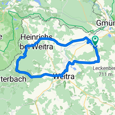
Waldviertel Umrundung 3
A cycling route starting in Gmünd, Lower Austria, Austria.
Overview
About this route
Der dritte Tag der <span id="title">Waldviertel Umrundung führt uns von Gmünd über Arbesbach in Richtung Bärenkopf. Wir folgen hauptsächlich der ausgeschilderten MTB Route Granit Trail. Obwohl es das Höhenprofil nicht vermuten läßt ist dieser Abschnitt unserer Radwoche ein eher anstrengender</span>
- -:--
- Duration
- 94.1 km
- Distance
- 1,780 m
- Ascent
- 1,473 m
- Descent
- ---
- Avg. speed
- 925 m
- Max. altitude

Route quality
Waytypes & surfaces along the route
Waytypes
Track
38.5 km
(41 %)
Road
23.9 km
(25 %)
Surfaces
Paved
29.4 km
(31 %)
Unpaved
29.3 km
(31 %)
Asphalt
21.5 km
(23 %)
Gravel
13 km
(14 %)
Continue with Bikemap
Use, edit, or download this cycling route
You would like to ride Waldviertel Umrundung 3 or customize it for your own trip? Here is what you can do with this Bikemap route:
Free features
- Save this route as favorite or in collections
- Copy & plan your own version of this route
- Split it into stages to create a multi-day tour
- Sync your route with Garmin or Wahoo
Premium features
Free trial for 3 days, or one-time payment. More about Bikemap Premium.
- Navigate this route on iOS & Android
- Export a GPX / KML file of this route
- Create your custom printout (try it for free)
- Download this route for offline navigation
Discover more Premium features.
Get Bikemap PremiumFrom our community
Other popular routes starting in Gmünd
 NatUrknallweg
- Distance
- 26.4 km
- Ascent
- 157 m
- Descent
- 154 m
- Location
- Gmünd, Lower Austria, Austria
 Mandelstein-Alt Weitra-Hörmanns
- Distance
- 35.9 km
- Ascent
- 598 m
- Descent
- 597 m
- Location
- Gmünd, Lower Austria, Austria
 Trainingsstrecke_1
- Distance
- 57.4 km
- Ascent
- 433 m
- Descent
- 437 m
- Location
- Gmünd, Lower Austria, Austria
 Waldviertel Umrundung 3
- Distance
- 94.1 km
- Ascent
- 1,780 m
- Descent
- 1,473 m
- Location
- Gmünd, Lower Austria, Austria
 Neighbour´s visit
- Distance
- 74.2 km
- Ascent
- 726 m
- Descent
- 751 m
- Location
- Gmünd, Lower Austria, Austria
 Gmünd - Rohrbach 2017
- Distance
- 113.9 km
- Ascent
- 833 m
- Descent
- 754 m
- Location
- Gmünd, Lower Austria, Austria
 Mandelstein-Sulz-Weitra
- Distance
- 48.2 km
- Ascent
- 566 m
- Descent
- 566 m
- Location
- Gmünd, Lower Austria, Austria
 Wasserlandschaft 24.09
- Distance
- 80 km
- Ascent
- 790 m
- Descent
- 784 m
- Location
- Gmünd, Lower Austria, Austria
Open it in the app