

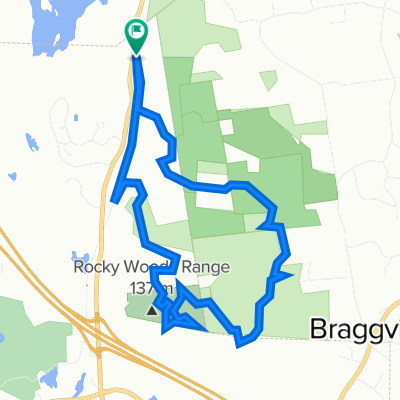
Upper Charles Bikepath
A cycling route starting in Hopkinton, Massachusetts, United States.
Overview
About this route
beautiful railtrail.
- -:--
- Duration
- 44.5 km
- Distance
- 120 m
- Ascent
- 120 m
- Descent
- ---
- Avg. speed
- ---
- Max. altitude

Route quality
Waytypes & surfaces along the route
Waytypes
Cycleway
37.9 km
(85 %)
Pedestrian area
1.3 km
(3 %)
Surfaces
Paved
19.6 km
(44 %)
Unpaved
19.6 km
(44 %)
Gravel
19.6 km
(44 %)
Asphalt
18.7 km
(42 %)
Continue with Bikemap
Use, edit, or download this cycling route
You would like to ride Upper Charles Bikepath or customize it for your own trip? Here is what you can do with this Bikemap route:
Free features
- Save this route as favorite or in collections
- Copy & plan your own version of this route
- Sync your route with Garmin or Wahoo
Premium features
Free trial for 3 days, or one-time payment. More about Bikemap Premium.
- Navigate this route on iOS & Android
- Export a GPX / KML file of this route
- Create your custom printout (try it for free)
- Download this route for offline navigation
Discover more Premium features.
Get Bikemap PremiumFrom our community
Other popular routes starting in Hopkinton
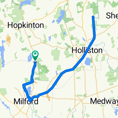
 Upper Charles Trail, Milford to Turner Rd, Holliston
- Distance
- 21.4 km
- Ascent
- 171 m
- Descent
- 198 m
- Location
- Hopkinton, Massachusetts, United States
 Holly Loop
- Distance
- 34.7 km
- Ascent
- 180 m
- Descent
- 183 m
- Location
- Hopkinton, Massachusetts, United States
 Milford 15 mile out and back
- Distance
- 12.5 km
- Ascent
- 68 m
- Descent
- 91 m
- Location
- Hopkinton, Massachusetts, United States
 Vietnam epic
- Distance
- 9.7 km
- Ascent
- 102 m
- Descent
- 101 m
- Location
- Hopkinton, Massachusetts, United States
 Vietnam
- Distance
- 12.1 km
- Ascent
- 112 m
- Descent
- 115 m
- Location
- Hopkinton, Massachusetts, United States
 Upper Charles Bikepath
- Distance
- 44.5 km
- Ascent
- 120 m
- Descent
- 120 m
- Location
- Hopkinton, Massachusetts, United States
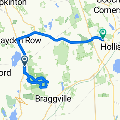 Vietnam
- Distance
- 18.3 km
- Ascent
- 151 m
- Descent
- 169 m
- Location
- Hopkinton, Massachusetts, United States
 Cedar Street 252, Milford to East Main Street 5, Milford
- Distance
- 7.1 km
- Ascent
- 39 m
- Descent
- 60 m
- Location
- Hopkinton, Massachusetts, United States
Open it in the app