
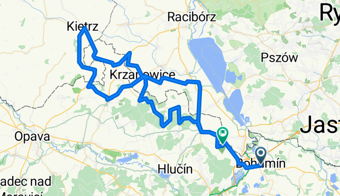


Bohumín-Ostrava
- 41.8 km
- 232 m
- 223 m
- Bohumín, Moravskoslezský kraj, Czechia
A cycling route starting in Bohumín, Moravskoslezský kraj, Czechia.
Overview
18.ročník Trasa: Bohumín <span class="caps">TGM</span> – Most přes Odru – Ostrava Antošovice – Šilheřovice – / <span class="caps">POLSKA</span> / – Rudyszwald – / ČR / – Hať – / <span class="caps">POLSKA</span> / – Tworkow – Boleslaw – Borucin – Kryzanowice – / ČR / – Strahovice – Kobeřice (pivo) – Hněvošice – / <span class="caps">POLSKA</span> / – Sciborzyce Wielkie – Kietrz – / ČR / – Třebom – Sudice – Sudice Rohov – / <span class="caps">POLSKA</span> / – Sambrowice – Pietraszyn – Krzyzanowice – / ČR / – Chuchelná – Chuchelná hřiště (pivo) – Bělá – Závada – Píšť – u Huberta – Hať – Šilheřovice Počasí : Ráno polojasno 12 st bezvětří, po 9 hodině slabý, později čerstvý JZ vítr 16 st, od 11 hodin zataženo okolo 12 hodiny první přeháňky ochlazení na 13 st, pak přeháňky, v Šilheřovicích déšť, od 18 hodin zataženo bez deště 11 st
created this 17 years ago
Continue with Bikemap
You would like to ride 2008-05-01 Prvomájová stovka 2008 or customize it for your own trip? Here is what you can do with this Bikemap route:
Free trial for 3 days, or one-time payment. More about Bikemap Premium.
Discover more Premium features.
Get Bikemap PremiumFrom our community
Open it in the app


