

De Rue Lucien Lobjoit 1, La Ferrière-Bochard à La Pallière 196, Mieuxcé
A cycling route starting in Saint-Denis-sur-Sarthon, Normandy, France.
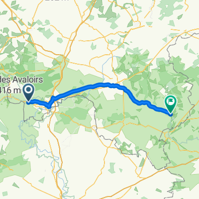
Overview
About this route
- 19 min
- Duration
- 3.7 km
- Distance
- 9 m
- Ascent
- 43 m
- Descent
- 11.9 km/h
- Avg. speed
- ---
- Max. altitude

Route quality
Waytypes & surfaces along the route
Waytypes
Road
2.8 km
(77 %)
Quiet road
0.8 km
(23 %)
Continue with Bikemap
Use, edit, or download this cycling route
You would like to ride De Rue Lucien Lobjoit 1, La Ferrière-Bochard à La Pallière 196, Mieuxcé or customize it for your own trip? Here is what you can do with this Bikemap route:
Free features
- Save this route as favorite or in collections
- Copy & plan your own version of this route
- Sync your route with Garmin or Wahoo
Premium features
Free trial for 3 days, or one-time payment. More about Bikemap Premium.
- Navigate this route on iOS & Android
- Export a GPX / KML file of this route
- Create your custom printout (try it for free)
- Download this route for offline navigation
Discover more Premium features.
Get Bikemap PremiumFrom our community
Other popular routes starting in Saint-Denis-sur-Sarthon
 mont avaloirs butte chaumont signal d'ecouves
- Distance
- 79.4 km
- Ascent
- 872 m
- Descent
- 872 m
- Location
- Saint-Denis-sur-Sarthon, Normandy, France
 La Ferriére-Béchet Loop
- Distance
- 32.4 km
- Ascent
- 674 m
- Descent
- 673 m
- Location
- Saint-Denis-sur-Sarthon, Normandy, France
 De Rue de la Billardière 21, La Ferrière-Bochard à Rue des Alpes Mancelles 24, La Ferrière-Bochard
- Distance
- 10.3 km
- Ascent
- 164 m
- Descent
- 175 m
- Location
- Saint-Denis-sur-Sarthon, Normandy, France
 Saint-Denis-sur-Sarthon - Condé-sur-Huisne
- Distance
- 74.8 km
- Ascent
- 321 m
- Descent
- 403 m
- Location
- Saint-Denis-sur-Sarthon, Normandy, France
 De Rue Pierre Petit 24, La Ferrière-Bochard à Impasse du Chêne 8, La Ferrière-Bochard
- Distance
- 1.1 km
- Ascent
- 4 m
- Descent
- 5 m
- Location
- Saint-Denis-sur-Sarthon, Normandy, France
 gm_20170727_6_wun_versailles_mont-st-michel
- Distance
- 5.5 km
- Ascent
- 93 m
- Descent
- 89 m
- Location
- Saint-Denis-sur-Sarthon, Normandy, France
 N12 82, Saint-Denis-sur-Sarthon to Avenue Pierre de Coubertin 109, Laval
- Distance
- 113.3 km
- Ascent
- 1,913 m
- Descent
- 2,027 m
- Location
- Saint-Denis-sur-Sarthon, Normandy, France
 Rouperroux Loop
- Distance
- 15.3 km
- Ascent
- 225 m
- Descent
- 224 m
- Location
- Saint-Denis-sur-Sarthon, Normandy, France
Open it in the app