36 Flums - Alp Fursch - Flums (Nr. 478)
A cycling route starting in Flums, Canton of St. Gallen, Switzerland.
Overview
About this route
- -:--
- Duration
- 36 km
- Distance
- 1,390 m
- Ascent
- 1,390 m
- Descent
- ---
- Avg. speed
- ---
- Avg. speed
Route quality
Waytypes & surfaces along the route
Waytypes
Track
16.2 km
(45 %)
Quiet road
14 km
(39 %)
Surfaces
Paved
22.5 km
(63 %)
Unpaved
10.6 km
(30 %)
Asphalt
13 km
(36 %)
Paved (undefined)
9.5 km
(26 %)
Continue with Bikemap
Use, edit, or download this cycling route
You would like to ride 36 Flums - Alp Fursch - Flums (Nr. 478) or customize it for your own trip? Here is what you can do with this Bikemap route:
Free features
- Save this route as favorite or in collections
- Copy & plan your own version of this route
- Sync your route with Garmin or Wahoo
Premium features
Free trial for 3 days, or one-time payment. More about Bikemap Premium.
- Navigate this route on iOS & Android
- Export a GPX / KML file of this route
- Create your custom printout (try it for free)
- Download this route for offline navigation
Discover more Premium features.
Get Bikemap PremiumFrom our community
Other popular routes starting in Flums
- Flumserberg zum Gondeli
- Distance
- 9.7 km
- Ascent
- 149 m
- Descent
- 232 m
- Location
- Flums, Canton of St. Gallen, Switzerland
- Flums-Unterterzen via Toggenburg
- Distance
- 89.4 km
- Ascent
- 1,655 m
- Descent
- 1,668 m
- Location
- Flums, Canton of St. Gallen, Switzerland
- Flums - Maschgenkamm - Flums
- Distance
- 36.1 km
- Ascent
- 1,556 m
- Descent
- 1,542 m
- Location
- Flums, Canton of St. Gallen, Switzerland
- 36 Flums - Alp Fursch - Flums (Nr. 478)
- Distance
- 36 km
- Ascent
- 1,390 m
- Descent
- 1,390 m
- Location
- Flums, Canton of St. Gallen, Switzerland
- Flumserberg-Maschgenkamm-Prodkamm
- Distance
- 18.9 km
- Ascent
- 790 m
- Descent
- 788 m
- Location
- Flums, Canton of St. Gallen, Switzerland
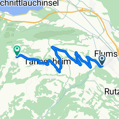
- Flums-Maschgenkamm-Fursch-Flums
- Distance
- 41.7 km
- Ascent
- ---
- Descent
- ---
- Location
- Flums, Canton of St. Gallen, Switzerland
- Cuhrfirstenunrundung
- Distance
- 133.5 km
- Ascent
- 1,234 m
- Descent
- 1,234 m
- Location
- Flums, Canton of St. Gallen, Switzerland
- bike tour through Flumserberg Theim
- Distance
- 23.1 km
- Ascent
- 771 m
- Descent
- 770 m
- Location
- Flums, Canton of St. Gallen, Switzerland
Open it in the app