

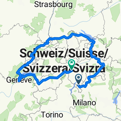
via 829 italia
A cycling route starting in Gravesano, Canton Ticino, Switzerland.
Overview
About this route
- -:--
- Duration
- 829.4 km
- Distance
- 1,294 m
- Ascent
- 1,612 m
- Descent
- ---
- Avg. speed
- ---
- Max. altitude

Route quality
Waytypes & surfaces along the route
Waytypes
Road
116.1 km
(14 %)
Quiet road
116.1 km
(14 %)
Surfaces
Paved
539.1 km
(65 %)
Unpaved
41.5 km
(5 %)
Asphalt
539.1 km
(65 %)
Gravel
16.6 km
(2 %)
Route highlights
Points of interest along the route
Point of interest after 99.4 km
1. torricella TI - tornaco NO 102km azienda agricola vignarello
Point of interest after 205.3 km
2. tornaco NO - novi ligure AL xxkm tenuta la marchesa
Point of interest after 319.9 km
3. novi ligure AL - lavagna GE xxxkm agriturismo villa rosa
Point of interest after 419.5 km
4. lavagna GE - massa carrara MS xxxkm fattoria battilana
Point of interest after 514.7 km
5. massa carrara MS - cecina LI xxkm fattoria di collemezzano
Point of interest after 603.8 km
6. cecina LI - castiglione della pescaia GR xxkm tenuta dei principi
Point of interest after 721.1 km
7. cecina LI - tarquinia VI xxkm agriturismo podere giulio
Point of interest after 829 km
8. tarquinia VI - roma xxkm b&b la casa di amy
Continue with Bikemap
Use, edit, or download this cycling route
You would like to ride via 829 italia or customize it for your own trip? Here is what you can do with this Bikemap route:
Free features
- Save this route as favorite or in collections
- Copy & plan your own version of this route
- Split it into stages to create a multi-day tour
- Sync your route with Garmin or Wahoo
Premium features
Free trial for 3 days, or one-time payment. More about Bikemap Premium.
- Navigate this route on iOS & Android
- Export a GPX / KML file of this route
- Create your custom printout (try it for free)
- Download this route for offline navigation
Discover more Premium features.
Get Bikemap PremiumFrom our community
Other popular routes starting in Gravesano
 Manno - Malcantone - Ponte Tresa
- Distance
- 57.5 km
- Ascent
- 1,294 m
- Descent
- 1,294 m
- Location
- Gravesano, Canton Ticino, Switzerland
 torricella . verbania . laveno
- Distance
- 117.8 km
- Ascent
- 692 m
- Descent
- 692 m
- Location
- Gravesano, Canton Ticino, Switzerland
 swiss border
- Distance
- 1,046.7 km
- Ascent
- 6,070 m
- Descent
- 5,303 m
- Location
- Gravesano, Canton Ticino, Switzerland
 torricella . rossura
- Distance
- 71.5 km
- Ascent
- 1,087 m
- Descent
- 420 m
- Location
- Gravesano, Canton Ticino, Switzerland
 torricella . piodella . melide
- Distance
- 41.2 km
- Ascent
- 490 m
- Descent
- 490 m
- Location
- Gravesano, Canton Ticino, Switzerland
 torricella . monti
- Distance
- 16 km
- Ascent
- 877 m
- Descent
- 877 m
- Location
- Gravesano, Canton Ticino, Switzerland
 castello valsolda
- Distance
- 46.9 km
- Ascent
- 754 m
- Descent
- 754 m
- Location
- Gravesano, Canton Ticino, Switzerland
 Monte Lema vom 15.05.2010
- Distance
- 19.6 km
- Ascent
- 295 m
- Descent
- 1,120 m
- Location
- Gravesano, Canton Ticino, Switzerland
Open it in the app