

Strada Garii, Răzvad to Strada Garii, Răzvad
A cycling route starting in Răzvad, Dâmbovița County, Romania.
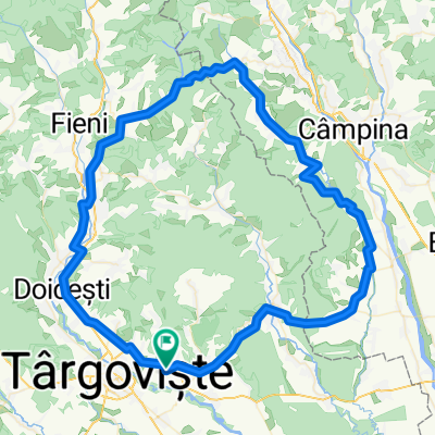
Overview
About this route
- -:--
- Duration
- 102.5 km
- Distance
- 1,234 m
- Ascent
- 1,234 m
- Descent
- ---
- Avg. speed
- ---
- Max. altitude
Route quality
Waytypes & surfaces along the route
Waytypes
Quiet road
26.7 km
(26 %)
Road
7.2 km
(7 %)
Surfaces
Paved
81 km
(79 %)
Unpaved
13.3 km
(13 %)
Asphalt
78.9 km
(77 %)
Gravel
12.3 km
(12 %)
Continue with Bikemap
Use, edit, or download this cycling route
You would like to ride Strada Garii, Răzvad to Strada Garii, Răzvad or customize it for your own trip? Here is what you can do with this Bikemap route:
Free features
- Save this route as favorite or in collections
- Copy & plan your own version of this route
- Split it into stages to create a multi-day tour
- Sync your route with Garmin or Wahoo
Premium features
Free trial for 3 days, or one-time payment. More about Bikemap Premium.
- Navigate this route on iOS & Android
- Export a GPX / KML file of this route
- Create your custom printout (try it for free)
- Download this route for offline navigation
Discover more Premium features.
Get Bikemap PremiumFrom our community
Other popular routes starting in Răzvad
 magureni pe deal
- Distance
- 32.1 km
- Ascent
- 722 m
- Descent
- 580 m
- Location
- Răzvad, Dâmbovița County, Romania
 Traseu Gura Ocnitei
- Distance
- 51.9 km
- Ascent
- 698 m
- Descent
- 701 m
- Location
- Răzvad, Dâmbovița County, Romania
 Târgoviște-Breaza-Moreni
- Distance
- 103.3 km
- Ascent
- 769 m
- Descent
- 770 m
- Location
- Răzvad, Dâmbovița County, Romania
 Strada Garii, Răzvad to Strada Garii, Răzvad
- Distance
- 10.1 km
- Ascent
- 118 m
- Descent
- 155 m
- Location
- Răzvad, Dâmbovița County, Romania
 Langa targoviste
- Distance
- 43.4 km
- Ascent
- 475 m
- Descent
- 475 m
- Location
- Răzvad, Dâmbovița County, Romania
 Strada Garii, Răzvad to Strada Garii, Răzvad
- Distance
- 102.5 km
- Ascent
- 1,234 m
- Descent
- 1,234 m
- Location
- Răzvad, Dâmbovița County, Romania
 tura de seara
- Distance
- 8.8 km
- Ascent
- 146 m
- Descent
- 145 m
- Location
- Răzvad, Dâmbovița County, Romania
 Strada Lunca 108, Răzvad to Strada Lunca 100, Răzvad
- Distance
- 18 km
- Ascent
- 123 m
- Descent
- 120 m
- Location
- Răzvad, Dâmbovița County, Romania
Open it in the app