

Grenoble-Morzine 2
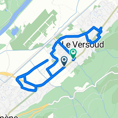
A cycling route starting in Le Versoud, Auvergne-Rhône-Alpes, France.
Overview
About this route
- -:--
- Duration
- 245.2 km
- Distance
- 4,243 m
- Ascent
- 3,479 m
- Descent
- ---
- Avg. speed
- ---
- Max. altitude
Route quality
Waytypes & surfaces along the route
Waytypes
Busy road
175.4 km
(72 %)
Road
44.2 km
(18 %)
Surfaces
Paved
192.3 km
(78 %)
Unpaved
0.3 km
(<1 %)
Asphalt
192.2 km
(78 %)
Loose gravel
0.3 km
(<1 %)
Continue with Bikemap
Use, edit, or download this cycling route
You would like to ride Grenoble-Morzine 2 or customize it for your own trip? Here is what you can do with this Bikemap route:
Free features
- Save this route as favorite or in collections
- Copy & plan your own version of this route
- Split it into stages to create a multi-day tour
- Sync your route with Garmin or Wahoo
Premium features
Free trial for 3 days, or one-time payment. More about Bikemap Premium.
- Navigate this route on iOS & Android
- Export a GPX / KML file of this route
- Create your custom printout (try it for free)
- Download this route for offline navigation
Discover more Premium features.
Get Bikemap PremiumFrom our community
Other popular routes starting in Le Versoud
 Le Versoud - Combeloup - Le Versoud
- Distance
- 32.3 km
- Ascent
- 804 m
- Descent
- 802 m
- Location
- Le Versoud, Auvergne-Rhône-Alpes, France
 coq_porte
- Distance
- 76.2 km
- Ascent
- 1,720 m
- Descent
- 1,719 m
- Location
- Le Versoud, Auvergne-Rhône-Alpes, France
 34 Avenue du 14 Juillet 1789, Le Versoud à 850 Rue Aimé Paquet, Saint-Vincent-de-Mercuze
- Distance
- 27.4 km
- Ascent
- 241 m
- Descent
- 122 m
- Location
- Le Versoud, Auvergne-Rhône-Alpes, France
 Sainte Agnes- Chambéry
- Distance
- 47.2 km
- Ascent
- 436 m
- Descent
- 368 m
- Location
- Le Versoud, Auvergne-Rhône-Alpes, France
 domene_porte_cucheron_granier
- Distance
- 97.4 km
- Ascent
- 1,953 m
- Descent
- 1,952 m
- Location
- Le Versoud, Auvergne-Rhône-Alpes, France
 hurtières, prapoutel puis balcons
- Distance
- 66.3 km
- Ascent
- 1,455 m
- Descent
- 1,455 m
- Location
- Le Versoud, Auvergne-Rhône-Alpes, France
 De Route de Lancey, Saint-Ismier à Place de l'Emendra 69, Crolles
- Distance
- 9.9 km
- Ascent
- 110 m
- Descent
- 149 m
- Location
- Le Versoud, Auvergne-Rhône-Alpes, France
 De Rue de la Tour à Rue de la Tour
- Distance
- 8.7 km
- Ascent
- 39 m
- Descent
- 98 m
- Location
- Le Versoud, Auvergne-Rhône-Alpes, France
Open it in the app