

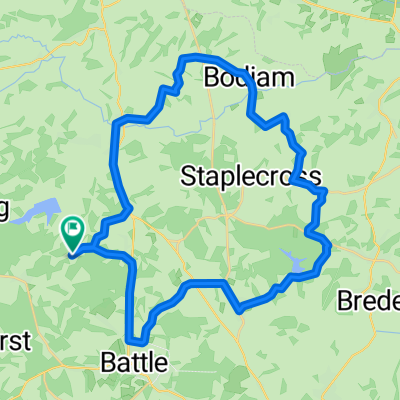
Peasmarsh_reverse
A cycling route starting in Robertsbridge, England, United Kingdom.
Overview
About this route
Route with a small rise
- -:--
- Duration
- 41.7 km
- Distance
- 371 m
- Ascent
- 374 m
- Descent
- ---
- Avg. speed
- ---
- Max. altitude

Continue with Bikemap
Use, edit, or download this cycling route
You would like to ride Peasmarsh_reverse or customize it for your own trip? Here is what you can do with this Bikemap route:
Free features
- Save this route as favorite or in collections
- Copy & plan your own version of this route
- Sync your route with Garmin or Wahoo
Premium features
Free trial for 3 days, or one-time payment. More about Bikemap Premium.
- Navigate this route on iOS & Android
- Export a GPX / KML file of this route
- Create your custom printout (try it for free)
- Download this route for offline navigation
Discover more Premium features.
Get Bikemap PremiumFrom our community
Other popular routes starting in Robertsbridge
 Bodiam (via Virgin Lane)
- Distance
- 37 km
- Ascent
- 353 m
- Descent
- 353 m
- Location
- Robertsbridge, England, United Kingdom
 Bodle Street Green
- Distance
- 33.7 km
- Ascent
- 401 m
- Descent
- 401 m
- Location
- Robertsbridge, England, United Kingdom
 L2B training
- Distance
- 65.9 km
- Ascent
- 402 m
- Descent
- 402 m
- Location
- Robertsbridge, England, United Kingdom
 Willingdon Lane
- Distance
- 29.7 km
- Ascent
- 458 m
- Descent
- 461 m
- Location
- Robertsbridge, England, United Kingdom
 Bodiam in reverse
- Distance
- 36.5 km
- Ascent
- 401 m
- Descent
- 401 m
- Location
- Robertsbridge, England, United Kingdom
 Rye and Winchelsea
- Distance
- 56.9 km
- Ascent
- 419 m
- Descent
- 419 m
- Location
- Robertsbridge, England, United Kingdom
 From Robertsbridge to Amsterdam
- Distance
- 558.1 km
- Ascent
- 1,358 m
- Descent
- 1,407 m
- Location
- Robertsbridge, England, United Kingdom
 Bodle Street - var II
- Distance
- 35.6 km
- Ascent
- 454 m
- Descent
- 454 m
- Location
- Robertsbridge, England, United Kingdom
Open it in the app