

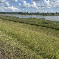
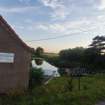
Oder, 1 Tag, Rundtour
A cycling route starting in Oderberg, Brandenburg, Germany.
Overview
About this route
- -:--
- Duration
- 49.9 km
- Distance
- 92 m
- Ascent
- 90 m
- Descent
- ---
- Avg. speed
- ---
- Max. altitude

Route quality
Waytypes & surfaces along the route
Waytypes
Road
14.5 km
(29 %)
Quiet road
14.5 km
(29 %)
Surfaces
Paved
31.9 km
(64 %)
Unpaved
3 km
(6 %)
Asphalt
30.4 km
(61 %)
Sand
2.5 km
(5 %)
Continue with Bikemap
Use, edit, or download this cycling route
You would like to ride Oder, 1 Tag, Rundtour or customize it for your own trip? Here is what you can do with this Bikemap route:
Free features
- Save this route as favorite or in collections
- Copy & plan your own version of this route
- Sync your route with Garmin or Wahoo
Premium features
Free trial for 3 days, or one-time payment. More about Bikemap Premium.
- Navigate this route on iOS & Android
- Export a GPX / KML file of this route
- Create your custom printout (try it for free)
- Download this route for offline navigation
Discover more Premium features.
Get Bikemap PremiumFrom our community
Other popular routes starting in Oderberg
 Oderstraße, Bad Freienwalde do Pod Zodiakiem, Kołbaskowo
- Distance
- 83.3 km
- Ascent
- 197 m
- Descent
- 184 m
- Location
- Oderberg, Brandenburg, Germany
 solo_2024_14_Hohenwutzen -
- Distance
- 113.6 km
- Ascent
- 455 m
- Descent
- 450 m
- Location
- Oderberg, Brandenburg, Germany
 Parsteiner See - Stettin
- Distance
- 89.5 km
- Ascent
- 210 m
- Descent
- 233 m
- Location
- Oderberg, Brandenburg, Germany
 Runde um das Schiffshebewerk Niederfinow 2012-07-08
- Distance
- 69.4 km
- Ascent
- 258 m
- Descent
- 261 m
- Location
- Oderberg, Brandenburg, Germany
 Oderrundfahrt
- Distance
- 35.1 km
- Ascent
- 66 m
- Descent
- 67 m
- Location
- Oderberg, Brandenburg, Germany
 Route nach Glietzener Straße 18, Bad Freienwalde (Oder)
- Distance
- 18.6 km
- Ascent
- 48 m
- Descent
- 43 m
- Location
- Oderberg, Brandenburg, Germany
 Niederfinow-Oder-Werbellinsee-Niederfinow
- Distance
- 107.4 km
- Ascent
- 356 m
- Descent
- 356 m
- Location
- Oderberg, Brandenburg, Germany
 Glietzener Straße 25, Bad Freienwalde (Oder) nach Freienwalder Straße 17, Bad Freienwalde (Oder)
- Distance
- 14.9 km
- Ascent
- 104 m
- Descent
- 105 m
- Location
- Oderberg, Brandenburg, Germany
Open it in the app