Botosani try
- 72.3 km
- 1,054 m
- 1,153 m
- Botoșani, Botoșani County, Romania
A cycling route starting in Botoșani, Botoșani County, Romania.
Overview
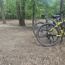
The marathon route is suitable for those with good physical condition and as a training route for those participating in XC competitions (made in reverse, it is more about pedaling uphill through the forests). In the forests, there are step descents, undulating trails, on roots, not on stones like you find in the mountains, and there are portions where you have to carry your bike. My cyclocomputer showed that I rode 66KM, probably due to a few small detours through the woods. I followed the marked route and in the forest at Ipotesti I climbed up to the Observator, from where I descended to the lake, then to the cabin where I went right alongside the barrier on the forest road to the European route. In the second forest, I took the first cart tracks to the right, which eventually get lost in the woods, but there are some markers and eventually you find other cart tracks. In the village of Mesteacan, I turned left to enter the forest next to the Forestry Office, and here as I have mentioned before, orientation can be difficult; I followed a marker that led me to a stream, and the marker continued in the stream bed where there were fallen trees from landslides, and although I know from Survivor that any watercourse leads to civilization, I didn't want to carry the bike over the fallen trees and through the water, so I headed south to a higher point and found another marker heading NW that ultimately took me across the stream bed to the forest road. On this tour, I had the pleasant surprise of a deer crossing my path 20m in front of me :).
created this 15 years ago
Route highlights

Caprioare
Continue with Bikemap
You would like to ride Tura maraton a padurilor din jurul orasului or customize it for your own trip? Here is what you can do with this Bikemap route:
Free trial for 3 days, or one-time payment. More about Bikemap Premium.
Discover more Premium features.
Get Bikemap PremiumFrom our community
Open it in the app