
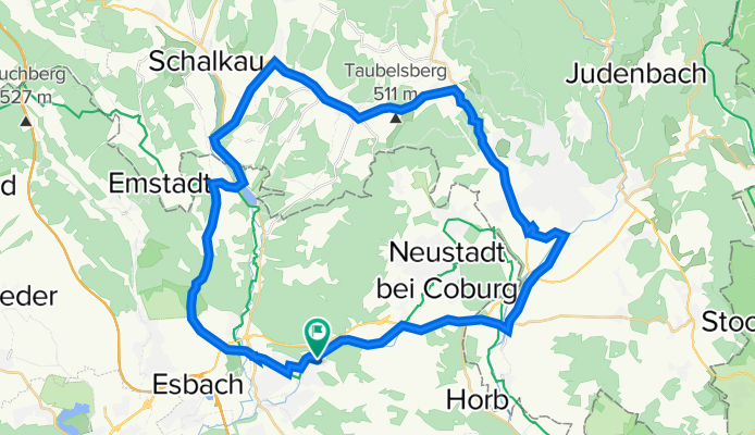
Um den Schönstettspeicher-Froschgrundsee
A cycling route starting in Rödental, Bavaria, Germany.
Overview
About this route
Bis Oberlind auf Radwegen in Sonneberg auf der neuen Umgehung ( Unterführung noch nicht frei gegeben. Den Isaak hoch in die Berge. Hinab nach Effelder und hinüber nach Grümpen. Die Itz hinab bis zum Schönstettspeicher-Froschgrundsee. Nach Unterwohlsbach ( Baustellen der B999 und der ICE Strecke Berlin-München
Insgesamt anspruchsvoll aber angenehm.
- -:--
- Duration
- 43.9 km
- Distance
- 335 m
- Ascent
- 335 m
- Descent
- ---
- Avg. speed
- ---
- Max. altitude

Route quality
Waytypes & surfaces along the route
Waytypes
Quiet road
14.8 km
(34 %)
Busy road
14.6 km
(33 %)
Surfaces
Paved
21.2 km
(48 %)
Unpaved
2.2 km
(5 %)
Asphalt
21.2 km
(48 %)
Unpaved (undefined)
1.5 km
(3 %)
Continue with Bikemap
Use, edit, or download this cycling route
You would like to ride Um den Schönstettspeicher-Froschgrundsee or customize it for your own trip? Here is what you can do with this Bikemap route:
Free features
- Save this route as favorite or in collections
- Copy & plan your own version of this route
- Sync your route with Garmin or Wahoo
Premium features
Free trial for 3 days, or one-time payment. More about Bikemap Premium.
- Navigate this route on iOS & Android
- Export a GPX / KML file of this route
- Create your custom printout (try it for free)
- Download this route for offline navigation
Discover more Premium features.
Get Bikemap PremiumFrom our community
Other popular routes starting in Rödental
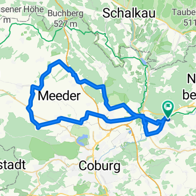
 Rund um die Rosenau
- Distance
- 15.4 km
- Ascent
- 134 m
- Descent
- 134 m
- Location
- Rödental, Bavaria, Germany
 Rödental - Rennsteig (bei Kleintettau)
- Distance
- 34.1 km
- Ascent
- 549 m
- Descent
- 231 m
- Location
- Rödental, Bavaria, Germany
 Rund um die Veste Coburg
- Distance
- 59.1 km
- Ascent
- 213 m
- Descent
- 213 m
- Location
- Rödental, Bavaria, Germany
 Kleine Runde gegen Pfunde.
- Distance
- 22.8 km
- Ascent
- 135 m
- Descent
- 135 m
- Location
- Rödental, Bavaria, Germany
 4Tälerweg -Röden-Itz-Lauter-Rodach
- Distance
- 39.6 km
- Ascent
- 551 m
- Descent
- 554 m
- Location
- Rödental, Bavaria, Germany
 Thüringisch-Fränkische Begegnung
- Distance
- 67.1 km
- Ascent
- 704 m
- Descent
- 708 m
- Location
- Rödental, Bavaria, Germany
 Landkreis Coburg ganz oben (Mirsdorf)
- Distance
- 42.1 km
- Ascent
- 309 m
- Descent
- 324 m
- Location
- Rödental, Bavaria, Germany
 Rund um Blumenrod
- Distance
- 22.6 km
- Ascent
- 226 m
- Descent
- 216 m
- Location
- Rödental, Bavaria, Germany
Open it in the app