

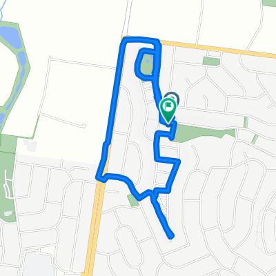
Home, Mooroolbark, Lilydale Loop
A cycling route starting in Chirnside Park, Victoria, Australia.
Overview
About this route
- 1 h 34 min
- Duration
- 20.4 km
- Distance
- 306 m
- Ascent
- 304 m
- Descent
- 13 km/h
- Avg. speed
- ---
- Max. altitude
Route quality
Waytypes & surfaces along the route
Waytypes
Cycleway
8.2 km
(40 %)
Quiet road
6.5 km
(32 %)
Surfaces
Paved
10.4 km
(51 %)
Unpaved
4.7 km
(23 %)
Asphalt
6.9 km
(34 %)
Gravel
3.9 km
(19 %)
Continue with Bikemap
Use, edit, or download this cycling route
You would like to ride Home, Mooroolbark, Lilydale Loop or customize it for your own trip? Here is what you can do with this Bikemap route:
Free features
- Save this route as favorite or in collections
- Copy & plan your own version of this route
- Sync your route with Garmin or Wahoo
Premium features
Free trial for 3 days, or one-time payment. More about Bikemap Premium.
- Navigate this route on iOS & Android
- Export a GPX / KML file of this route
- Create your custom printout (try it for free)
- Download this route for offline navigation
Discover more Premium features.
Get Bikemap PremiumFrom our community
Other popular routes starting in Chirnside Park
 Slow ride in Chirnside Park
- Distance
- 3.7 km
- Ascent
- 84 m
- Descent
- 76 m
- Location
- Chirnside Park, Victoria, Australia
 Route to 32–38-40 Reserve Road, Wonga Park
- Distance
- 5.5 km
- Ascent
- 312 m
- Descent
- 320 m
- Location
- Chirnside Park, Victoria, Australia
 Restful route in Chirnside Park
- Distance
- 5 km
- Ascent
- 68 m
- Descent
- 77 m
- Location
- Chirnside Park, Victoria, Australia
 Chirnside park to diamond creek
- Distance
- 26.3 km
- Ascent
- 354 m
- Descent
- 368 m
- Location
- Chirnside Park, Victoria, Australia
 Home Mooroolbark loop
- Distance
- 18.5 km
- Ascent
- 148 m
- Descent
- 137 m
- Location
- Chirnside Park, Victoria, Australia
 8 Wiltshire Place, Chirnside Park to 8 Wiltshire Place, Chirnside Park
- Distance
- 15.5 km
- Ascent
- 198 m
- Descent
- 198 m
- Location
- Chirnside Park, Victoria, Australia
 Home, Mooroolbark, Lilydale Loop
- Distance
- 20.4 km
- Ascent
- 306 m
- Descent
- 304 m
- Location
- Chirnside Park, Victoria, Australia
 Croydon- Lilydale Loop
- Distance
- 24.8 km
- Ascent
- 298 m
- Descent
- 299 m
- Location
- Chirnside Park, Victoria, Australia
Open it in the app