
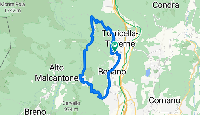
torricella . monti . arosio
A cycling route starting in Gravesano, Canton Ticino, Switzerland.
Overview
About this route
descrizione percorso:
via ai cioss (%!)
sentiero dei ciòs
nucleo torricella
strada ai monti
bivio per monti di torricella (820 mslm)
sentiero per arosio
discesa dalla penudria
- -:--
- Duration
- 12.3 km
- Distance
- 697 m
- Ascent
- 697 m
- Descent
- ---
- Avg. speed
- ---
- Avg. speed

Route highlights
Points of interest along the route
Point of interest after 0.4 km
pendenza!!!
Point of interest after 1.5 km
pendenza!
Point of interest after 3.9 km
pendenza!
Point of interest after 5.1 km
spingere in alcuni punti
Continue with Bikemap
Use, edit, or download this cycling route
You would like to ride torricella . monti . arosio or customize it for your own trip? Here is what you can do with this Bikemap route:
Free features
- Save this route as favorite or in collections
- Copy & plan your own version of this route
- Sync your route with Garmin or Wahoo
Premium features
Free trial for 3 days, or one-time payment. More about Bikemap Premium.
- Navigate this route on iOS & Android
- Export a GPX / KML file of this route
- Create your custom printout (try it for free)
- Download this route for offline navigation
Discover more Premium features.
Get Bikemap PremiumFrom our community
Other popular routes starting in Gravesano
 castello valsolda
- Distance
- 46.9 km
- Ascent
- 754 m
- Descent
- 754 m
- Location
- Gravesano, Canton Ticino, Switzerland
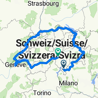 swiss border
- Distance
- 1,046.7 km
- Ascent
- 6,070 m
- Descent
- 5,303 m
- Location
- Gravesano, Canton Ticino, Switzerland
 torricella . verbania . laveno
- Distance
- 117.8 km
- Ascent
- 692 m
- Descent
- 692 m
- Location
- Gravesano, Canton Ticino, Switzerland
 giro lago ceresio
- Distance
- 65.9 km
- Ascent
- 363 m
- Descent
- 363 m
- Location
- Gravesano, Canton Ticino, Switzerland
 via 829 italia
- Distance
- 829.4 km
- Ascent
- 1,294 m
- Descent
- 1,612 m
- Location
- Gravesano, Canton Ticino, Switzerland
 torricella . rossura
- Distance
- 71.5 km
- Ascent
- 1,087 m
- Descent
- 420 m
- Location
- Gravesano, Canton Ticino, Switzerland
 torricella . mte ceneri
- Distance
- 30.7 km
- Ascent
- 338 m
- Descent
- 338 m
- Location
- Gravesano, Canton Ticino, Switzerland
 Manno - Malcantone - Ponte Tresa
- Distance
- 57.5 km
- Ascent
- 1,294 m
- Descent
- 1,294 m
- Location
- Gravesano, Canton Ticino, Switzerland
Open it in the app