

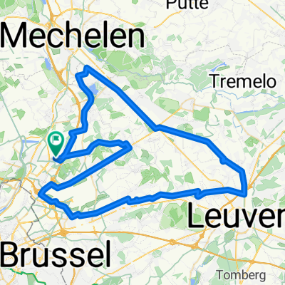
Kanaalroute Vilvoorde
A cycling route starting in Vilvoorde, Flemish Region, Belgium.
Overview
About this route
Afstand : 40 km - Bewegwijzering : ja, goed aangeduid en overal zichtbaar; geen overzichtsplan beschikbaar - Aard van de weg : 3 km kassei, een kort stuk bospad, en verder volledig verhard - Hellingen : 2 korte maar nijdige hellingen in het begin van het parcours - Startplaats : Grote Markt, Vilvoorde (betalend); alternatieve startplaats in het Domein Drie Fonteinen (gratis)
- 2 h 45 min
- Duration
- 40.5 km
- Distance
- 147 m
- Ascent
- 145 m
- Descent
- 14.7 km/h
- Avg. speed
- ---
- Max. altitude

Route quality
Waytypes & surfaces along the route
Waytypes
Quiet road
21.4 km
(53 %)
Cycleway
6.7 km
(17 %)
Surfaces
Paved
18.9 km
(47 %)
Unpaved
2.9 km
(7 %)
Asphalt
9.7 km
(24 %)
Paved (undefined)
6.2 km
(15 %)
Continue with Bikemap
Use, edit, or download this cycling route
You would like to ride Kanaalroute Vilvoorde or customize it for your own trip? Here is what you can do with this Bikemap route:
Free features
- Save this route as favorite or in collections
- Copy & plan your own version of this route
- Sync your route with Garmin or Wahoo
Premium features
Free trial for 3 days, or one-time payment. More about Bikemap Premium.
- Navigate this route on iOS & Android
- Export a GPX / KML file of this route
- Create your custom printout (try it for free)
- Download this route for offline navigation
Discover more Premium features.
Get Bikemap PremiumFrom our community
Other popular routes starting in Vilvoorde
 Eddy Merckx Route (80K)
- Distance
- 81.6 km
- Ascent
- 164 m
- Descent
- 165 m
- Location
- Vilvoorde, Flemish Region, Belgium
 otra
otra- Distance
- 18.7 km
- Ascent
- 17 m
- Descent
- 23 m
- Location
- Vilvoorde, Flemish Region, Belgium
 brux-antwerp-brux
- Distance
- 98.6 km
- Ascent
- 60 m
- Descent
- 61 m
- Location
- Vilvoorde, Flemish Region, Belgium
 Mechelen/Kapelle-op-den-bos/Vilvorde
- Distance
- 36.9 km
- Ascent
- 68 m
- Descent
- 68 m
- Location
- Vilvoorde, Flemish Region, Belgium
 Vaart - HST Route (70K)
- Distance
- 72.3 km
- Ascent
- 77 m
- Descent
- 77 m
- Location
- Vilvoorde, Flemish Region, Belgium
 Alternative northern loop for Gordel
- Distance
- 30.1 km
- Ascent
- 117 m
- Descent
- 52 m
- Location
- Vilvoorde, Flemish Region, Belgium
 Kanaalroute Vilvoorde
- Distance
- 40.5 km
- Ascent
- 147 m
- Descent
- 145 m
- Location
- Vilvoorde, Flemish Region, Belgium
 Alongside Canal
- Distance
- 45.3 km
- Ascent
- 27 m
- Descent
- 28 m
- Location
- Vilvoorde, Flemish Region, Belgium
Open it in the app