

Modsiedl Drosendorf
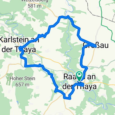
A cycling route starting in Raabs an der Thaya, Lower Austria, Austria.
Overview
About this route
Von Modsiedl zur Übernachtung nach Drosendorf
- -:--
- Duration
- 11.1 km
- Distance
- 108 m
- Ascent
- 224 m
- Descent
- ---
- Avg. speed
- ---
- Max. altitude

Route quality
Waytypes & surfaces along the route
Waytypes
Road
9.9 km
(90 %)
Quiet road
0.6 km
(5 %)
Surfaces
Paved
4.8 km
(44 %)
Unpaved
0.2 km
(2 %)
Asphalt
4.8 km
(44 %)
Ground
0.2 km
(2 %)
Undefined
6 km
(54 %)
Continue with Bikemap
Use, edit, or download this cycling route
You would like to ride Modsiedl Drosendorf or customize it for your own trip? Here is what you can do with this Bikemap route:
Free features
- Save this route as favorite or in collections
- Copy & plan your own version of this route
- Sync your route with Garmin or Wahoo
Premium features
Free trial for 3 days, or one-time payment. More about Bikemap Premium.
- Navigate this route on iOS & Android
- Export a GPX / KML file of this route
- Create your custom printout (try it for free)
- Download this route for offline navigation
Discover more Premium features.
Get Bikemap PremiumFrom our community
Other popular routes starting in Raabs an der Thaya
 Thayarunde Entwurf 4
- Distance
- 72.6 km
- Ascent
- 563 m
- Descent
- 388 m
- Location
- Raabs an der Thaya, Lower Austria, Austria
 Hauptstraße nach Hauptstraße
- Distance
- 63.9 km
- Ascent
- 885 m
- Descent
- 983 m
- Location
- Raabs an der Thaya, Lower Austria, Austria
 Route Radrunde Raabs an der Thaya
- Distance
- 33.5 km
- Ascent
- 504 m
- Descent
- 505 m
- Location
- Raabs an der Thaya, Lower Austria, Austria
 Modsiedl Drosendorf
- Distance
- 11.1 km
- Ascent
- 108 m
- Descent
- 224 m
- Location
- Raabs an der Thaya, Lower Austria, Austria
 Thayarunde Alternative 1 zu Entwurf 4
- Distance
- 60 km
- Ascent
- 546 m
- Descent
- 371 m
- Location
- Raabs an der Thaya, Lower Austria, Austria
 Thayarunde Waldviertel Etappe 1
- Distance
- 55.8 km
- Ascent
- 641 m
- Descent
- 556 m
- Location
- Raabs an der Thaya, Lower Austria, Austria
 31.07.10 - Einrollrunde an der Thaya
- Distance
- 27.1 km
- Ascent
- 397 m
- Descent
- 395 m
- Location
- Raabs an der Thaya, Lower Austria, Austria
 Burgenrundfahrt im Nördlichen Waldviertel
- Distance
- 79.6 km
- Ascent
- 687 m
- Descent
- 687 m
- Location
- Raabs an der Thaya, Lower Austria, Austria
Open it in the app