

Ostrovská
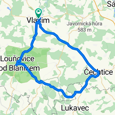
A cycling route starting in Vlašim, Central Bohemia, Czechia.
Overview
About this route
The route follows both paved roads and unpaved paths. It isn't fully marked on the map, but you can easily get to Hradiště from a turnoff at the end of Polánky, and from Ostrov there is a bike path leading to Kondrac. A great route with beautiful views of Blaník.
- -:--
- Duration
- 28.1 km
- Distance
- 344 m
- Ascent
- 344 m
- Descent
- ---
- Avg. speed
- ---
- Max. altitude

Route quality
Waytypes & surfaces along the route
Waytypes
Road
9.9 km
(35 %)
Quiet road
8.4 km
(30 %)
Surfaces
Paved
7.9 km
(28 %)
Unpaved
3.4 km
(12 %)
Asphalt
7.9 km
(28 %)
Gravel
2 km
(7 %)
Continue with Bikemap
Use, edit, or download this cycling route
You would like to ride Ostrovská or customize it for your own trip? Here is what you can do with this Bikemap route:
Free features
- Save this route as favorite or in collections
- Copy & plan your own version of this route
- Sync your route with Garmin or Wahoo
Premium features
Free trial for 3 days, or one-time payment. More about Bikemap Premium.
- Navigate this route on iOS & Android
- Export a GPX / KML file of this route
- Create your custom printout (try it for free)
- Download this route for offline navigation
Discover more Premium features.
Get Bikemap PremiumFrom our community
Other popular routes starting in Vlašim
 Načeradec
- Distance
- 34.4 km
- Ascent
- 472 m
- Descent
- 472 m
- Location
- Vlašim, Central Bohemia, Czechia
 27. 4. 2015 Ténink na cestě z Prahy
- Distance
- 49.9 km
- Ascent
- 644 m
- Descent
- 645 m
- Location
- Vlašim, Central Bohemia, Czechia
 Časovka Divišov a zpět
- Distance
- 25.9 km
- Ascent
- 353 m
- Descent
- 353 m
- Location
- Vlašim, Central Bohemia, Czechia
 Vlašim - Louňovice - Horní Lhota - Pravonín - Křivsoudov - Borovnice
- Distance
- 57.1 km
- Ascent
- 628 m
- Descent
- 630 m
- Location
- Vlašim, Central Bohemia, Czechia
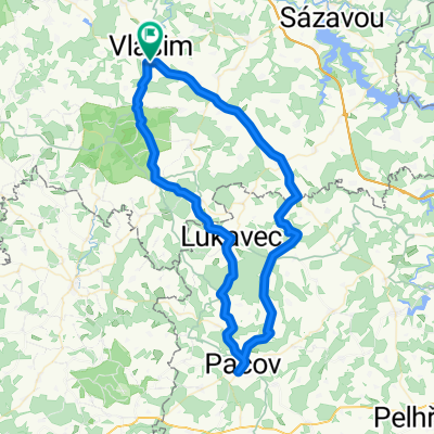 Vlašim-Načeradec-Lukavec-Pacov-Čechtice-Vlašim
- Distance
- 71.1 km
- Ascent
- 737 m
- Descent
- 734 m
- Location
- Vlašim, Central Bohemia, Czechia
 Vla-Pacov-Hum-Led-Zru-Vla
- Distance
- 147.1 km
- Ascent
- 1,137 m
- Descent
- 1,115 m
- Location
- Vlašim, Central Bohemia, Czechia
 Vlašim - Blanik Želivka Tour
- Distance
- 70.2 km
- Ascent
- 1,075 m
- Descent
- 1,053 m
- Location
- Vlašim, Central Bohemia, Czechia
 Římovice
- Distance
- 2.6 km
- Ascent
- 64 m
- Descent
- 0 m
- Location
- Vlašim, Central Bohemia, Czechia
Open it in the app