

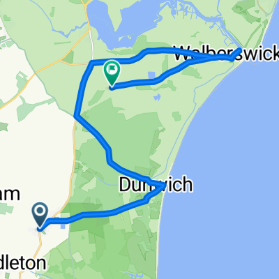
Day 3 - Walberswick
A cycling route starting in Leiston, England, United Kingdom.
Overview
About this route
- -:--
- Duration
- 19 km
- Distance
- 68 m
- Ascent
- 73 m
- Descent
- ---
- Avg. speed
- ---
- Max. altitude
Route quality
Waytypes & surfaces along the route
Waytypes
Quiet road
10.3 km
(54 %)
Track
0.8 km
(4 %)
Surfaces
Paved
9.3 km
(49 %)
Unpaved
1 km
(5 %)
Asphalt
9.3 km
(49 %)
Sand
0.6 km
(3 %)
Continue with Bikemap
Use, edit, or download this cycling route
You would like to ride Day 3 - Walberswick or customize it for your own trip? Here is what you can do with this Bikemap route:
Free features
- Save this route as favorite or in collections
- Copy & plan your own version of this route
- Sync your route with Garmin or Wahoo
Premium features
Free trial for 3 days, or one-time payment. More about Bikemap Premium.
- Navigate this route on iOS & Android
- Export a GPX / KML file of this route
- Create your custom printout (try it for free)
- Download this route for offline navigation
Discover more Premium features.
Get Bikemap PremiumFrom our community
Other popular routes starting in Leiston
 First Suffolk Ride
- Distance
- 12.5 km
- Ascent
- 37 m
- Descent
- 34 m
- Location
- Leiston, England, United Kingdom
 Alternative Train Route
- Distance
- 9.3 km
- Ascent
- 0 m
- Descent
- 0 m
- Location
- Leiston, England, United Kingdom
 Day 3 - Walberswick
- Distance
- 19 km
- Ascent
- 68 m
- Descent
- 73 m
- Location
- Leiston, England, United Kingdom
 Sizewell
- Distance
- 9.3 km
- Ascent
- 68 m
- Descent
- 69 m
- Location
- Leiston, England, United Kingdom
 Dunwich backwards
- Distance
- 18.6 km
- Ascent
- 71 m
- Descent
- 65 m
- Location
- Leiston, England, United Kingdom
 Railway Line, Thorpeness, Leiston to Aldeburgh, Aldeburgh
- Distance
- 1.2 km
- Ascent
- 0 m
- Descent
- 0 m
- Location
- Leiston, England, United Kingdom
 Day 4 - Westleton - Foulsham
- Distance
- 86.6 km
- Ascent
- 190 m
- Descent
- 158 m
- Location
- Leiston, England, United Kingdom
 Dunwich Aldeburgh loop
- Distance
- 46.7 km
- Ascent
- 118 m
- Descent
- 116 m
- Location
- Leiston, England, United Kingdom
Open it in the app