

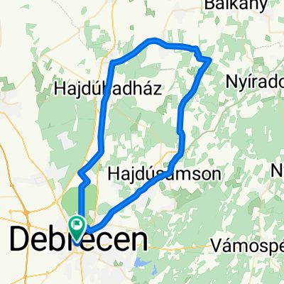
XD51 102km Nyírségi Templomromok
A cycling route starting in Debrecen, Hajdú-Bihar, Hungary.
Overview
About this route
- -:--
- Duration
- 102.6 km
- Distance
- 72 m
- Ascent
- 72 m
- Descent
- ---
- Avg. speed
- ---
- Max. altitude

Route quality
Waytypes & surfaces along the route
Waytypes
Quiet road
35.8 km
(35 %)
Cycleway
30.3 km
(30 %)
Surfaces
Paved
58.9 km
(57 %)
Unpaved
3.4 km
(3 %)
Asphalt
53.8 km
(52 %)
Paved (undefined)
4.5 km
(4 %)
Route highlights
Points of interest along the route
Point of interest after 13.8 km
Pallagi Templomrom
Point of interest after 49 km
Gúti templomrom
Point of interest after 64 km
Reviczky kilátó
Point of interest after 64.3 km
Reviczky kastély
Point of interest after 65.1 km
Reviczky tanösvény
Point of interest after 72.2 km
Dombtető kilátással
Continue with Bikemap
Use, edit, or download this cycling route
You would like to ride XD51 102km Nyírségi Templomromok or customize it for your own trip? Here is what you can do with this Bikemap route:
Free features
- Save this route as favorite or in collections
- Copy & plan your own version of this route
- Split it into stages to create a multi-day tour
- Sync your route with Garmin or Wahoo
Premium features
Free trial for 3 days, or one-time payment. More about Bikemap Premium.
- Navigate this route on iOS & Android
- Export a GPX / KML file of this route
- Create your custom printout (try it for free)
- Download this route for offline navigation
Discover more Premium features.
Get Bikemap PremiumFrom our community
Other popular routes starting in Debrecen
 Nagy-Magyarország határvidék körtúra
- Distance
- 5,159.5 km
- Ascent
- 20,236 m
- Descent
- 20,235 m
- Location
- Debrecen, Hajdú-Bihar, Hungary
 Db 40+
- Distance
- 44.7 km
- Ascent
- 1,082 m
- Descent
- 1,086 m
- Location
- Debrecen, Hajdú-Bihar, Hungary
 Debrecen – Újpest
- Distance
- 237 km
- Ascent
- 202 m
- Descent
- 209 m
- Location
- Debrecen, Hajdú-Bihar, Hungary
 Pallag All-Star
- Distance
- 15.9 km
- Ascent
- 31 m
- Descent
- 30 m
- Location
- Debrecen, Hajdú-Bihar, Hungary
 DB-Ex2 | Mamutfenyő
- Distance
- 64.2 km
- Ascent
- 54 m
- Descent
- 58 m
- Location
- Debrecen, Hajdú-Bihar, Hungary
 Jósza Lit-run
- Distance
- 17.9 km
- Ascent
- 27 m
- Descent
- 26 m
- Location
- Debrecen, Hajdú-Bihar, Hungary
 DB-Er6 | Erdőspusztai kerékpártúra (nyír)
- Distance
- 76.8 km
- Ascent
- 62 m
- Descent
- 60 m
- Location
- Debrecen, Hajdú-Bihar, Hungary
 Experimental Route #1
- Distance
- 14 km
- Ascent
- 28 m
- Descent
- 26 m
- Location
- Debrecen, Hajdú-Bihar, Hungary
Open it in the app