

r1r2r3
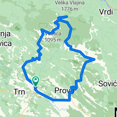
A cycling route starting in Široki Brijeg, Federation of Bosnia and Herzegovina, Bosnia and Herzegovina.
Overview
About this route
- -:--
- Duration
- 43.8 km
- Distance
- 256 m
- Ascent
- 254 m
- Descent
- ---
- Avg. speed
- ---
- Max. altitude

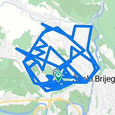
Route photos

Route quality
Waytypes & surfaces along the route
Waytypes
Quiet road
10.1 km
(23 %)
Access road
0.4 km
(1 %)
Undefined
33.3 km
(76 %)
Surfaces
Paved
34.2 km
(78 %)
Unpaved
0.4 km
(1 %)
Asphalt
33.7 km
(77 %)
Paved (undefined)
0.4 km
(1 %)
Continue with Bikemap
Use, edit, or download this cycling route
You would like to ride r1r2r3 or customize it for your own trip? Here is what you can do with this Bikemap route:
Free features
- Save this route as favorite or in collections
- Copy & plan your own version of this route
- Sync your route with Garmin or Wahoo
Premium features
Free trial for 3 days, or one-time payment. More about Bikemap Premium.
- Navigate this route on iOS & Android
- Export a GPX / KML file of this route
- Create your custom printout (try it for free)
- Download this route for offline navigation
Discover more Premium features.
Get Bikemap PremiumFrom our community
Other popular routes starting in Široki Brijeg
 L105 – Široki Brijeg – Uzarići - Podgorje – Miljkovići- Knešpolje - Široki Brijeg
- Distance
- 42.6 km
- Ascent
- 393 m
- Descent
- 390 m
- Location
- Široki Brijeg, Federation of Bosnia and Herzegovina, Bosnia and Herzegovina
 Š.B. - ČABULJA -Š.B.
- Distance
- 59.6 km
- Ascent
- 1,590 m
- Descent
- 1,588 m
- Location
- Široki Brijeg, Federation of Bosnia and Herzegovina, Bosnia and Herzegovina
 Steady ride
- Distance
- 20.7 km
- Ascent
- 254 m
- Descent
- 298 m
- Location
- Široki Brijeg, Federation of Bosnia and Herzegovina, Bosnia and Herzegovina
 Herzegovina MTB
- Distance
- 128.3 km
- Ascent
- 1,700 m
- Descent
- 1,698 m
- Location
- Široki Brijeg, Federation of Bosnia and Herzegovina, Bosnia and Herzegovina
 Franciskana Cestovna
- Distance
- 457.5 km
- Ascent
- 6,271 m
- Descent
- 6,275 m
- Location
- Široki Brijeg, Federation of Bosnia and Herzegovina, Bosnia and Herzegovina
 Restful route
- Distance
- 1.2 km
- Ascent
- 3 m
- Descent
- 56 m
- Location
- Široki Brijeg, Federation of Bosnia and Herzegovina, Bosnia and Herzegovina
 Franciskana MTB
- Distance
- 377.7 km
- Ascent
- 5,216 m
- Descent
- 5,217 m
- Location
- Široki Brijeg, Federation of Bosnia and Herzegovina, Bosnia and Herzegovina
 Široki - Klobuk (kroz sela) - Široki
- Distance
- 43.5 km
- Ascent
- 538 m
- Descent
- 545 m
- Location
- Široki Brijeg, Federation of Bosnia and Herzegovina, Bosnia and Herzegovina
Open it in the app