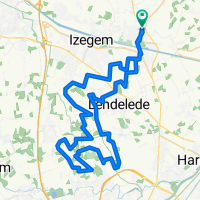

beitem1 - 39.2
- 39.2 km
- 83 m
- 83 m
- Ingelmunster, Flemish Region, Belgium
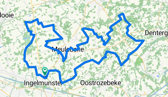
Overview
created this 5 years ago
Part of
11 stages
Route quality
Quiet road
49 km
92 %
Road
2.7 km
5 %
Paved
20.3 km
(38 %)
Asphalt
18.7 km
35 %
Concrete
1.6 km
3 %
Undefined
33 km
62 %
Route highlights

hazeveld

serres


ttc meulebeke

kapel van bijstand


herentmolen
zelfpluktuin
ten huize (belle vue)

poelbergmolen
school
debrabandere
kipco


gevaarlijke oversteekplaats
boerhof danny


carlu


deselec

Continue with Bikemap
You would like to ride berenroute - 53.3 or customize it for your own trip? Here is what you can do with this Bikemap route:
Free trial for 3 days, or one-time payment. More about Bikemap Premium.
Discover more Premium features.
Get Bikemap PremiumFrom our community
Open it in the app