

Grobnik - black (with wrong beginning :-))
A cycling route starting in Dražice, Primorje-Gorski Kotar County, Croatia.
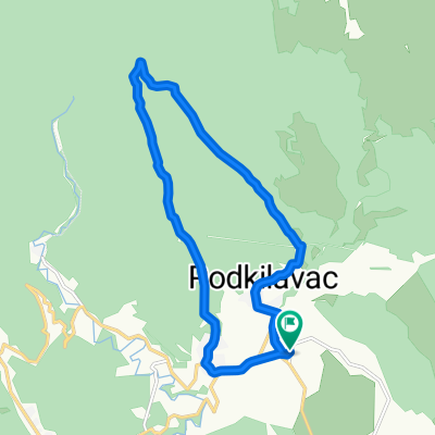
Overview
About this route
<span id="result_box" lang="en"><span>Rather difficult trail through the woods.</span></span>
<span id="result_box" lang="en"><span>Start demanding (</span></span>specially if you miss beginning of rute like me)
<span id="result_box" lang="en"><span>Second half of a trail is beautiful descent.</span></span>
<span id="result_box" lang="en"><span><br /></span></span>
- -:--
- Duration
- 13.3 km
- Distance
- 292 m
- Ascent
- 291 m
- Descent
- ---
- Avg. speed
- ---
- Max. altitude

Route highlights
Points of interest along the route
Accommodation after 2.6 km
Don't go left like we did!
Accommodation after 4.2 km
Until here is wrong part of rute
Continue with Bikemap
Use, edit, or download this cycling route
You would like to ride Grobnik - black (with wrong beginning :-)) or customize it for your own trip? Here is what you can do with this Bikemap route:
Free features
- Save this route as favorite or in collections
- Copy & plan your own version of this route
- Sync your route with Garmin or Wahoo
Premium features
Free trial for 3 days, or one-time payment. More about Bikemap Premium.
- Navigate this route on iOS & Android
- Export a GPX / KML file of this route
- Create your custom printout (try it for free)
- Download this route for offline navigation
Discover more Premium features.
Get Bikemap PremiumFrom our community
Other popular routes starting in Dražice
 Pakleno Hahlić Kolci
- Distance
- 23.7 km
- Ascent
- 1,011 m
- Descent
- 1,088 m
- Location
- Dražice, Primorje-Gorski Kotar County, Croatia
 05. Grobnik - zelena
- Distance
- 11.1 km
- Ascent
- 80 m
- Descent
- 80 m
- Location
- Dražice, Primorje-Gorski Kotar County, Croatia
 Grobnik - plinovod
- Distance
- 15.5 km
- Ascent
- 259 m
- Descent
- 259 m
- Location
- Dražice, Primorje-Gorski Kotar County, Croatia
 Sijevice-Podkilavac preko plinovoda
- Distance
- 2.7 km
- Ascent
- 213 m
- Descent
- 22 m
- Location
- Dražice, Primorje-Gorski Kotar County, Croatia
 BM-ODV-01 Grobnik - crna
- Distance
- 15.4 km
- Ascent
- 313 m
- Descent
- 313 m
- Location
- Dražice, Primorje-Gorski Kotar County, Croatia
 Grobnik - zelena kruzna
- Distance
- 11.1 km
- Ascent
- 80 m
- Descent
- 80 m
- Location
- Dražice, Primorje-Gorski Kotar County, Croatia
 Grobnik - crna (teza) kruzna
- Distance
- 13.3 km
- Ascent
- 295 m
- Descent
- 298 m
- Location
- Dražice, Primorje-Gorski Kotar County, Croatia
 ODV-Dražice - Kičej - Martinovo selo - Dražice II
- Distance
- 19.1 km
- Ascent
- 362 m
- Descent
- 364 m
- Location
- Dražice, Primorje-Gorski Kotar County, Croatia
Open it in the app