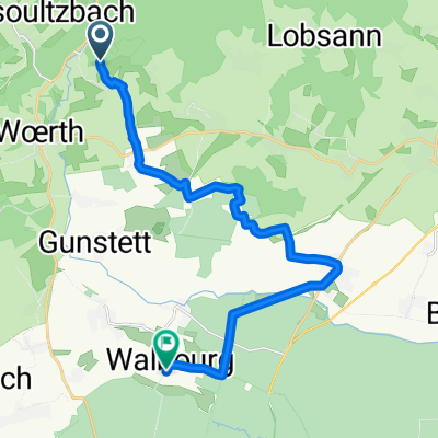
alsace du nord
A cycling route starting in Gœrsdorf, Grand Est, France.
Overview
About this route
- -:--
- Duration
- 32.8 km
- Distance
- 701 m
- Ascent
- 673 m
- Descent
- ---
- Avg. speed
- 412 m
- Max. altitude
Route quality
Waytypes & surfaces along the route
Waytypes
Road
17.4 km
(53 %)
Quiet road
9.5 km
(29 %)
Surfaces
Paved
7.9 km
(24 %)
Unpaved
3 km
(9 %)
Asphalt
7.9 km
(24 %)
Unpaved (undefined)
1.3 km
(4 %)
Continue with Bikemap
Use, edit, or download this cycling route
You would like to ride alsace du nord or customize it for your own trip? Here is what you can do with this Bikemap route:
Free features
- Save this route as favorite or in collections
- Copy & plan your own version of this route
- Sync your route with Garmin or Wahoo
Premium features
Free trial for 3 days, or one-time payment. More about Bikemap Premium.
- Navigate this route on iOS & Android
- Export a GPX / KML file of this route
- Create your custom printout (try it for free)
- Download this route for offline navigation
Discover more Premium features.
Get Bikemap PremiumFrom our community
Other popular routes starting in Gœrsdorf
- FR3HD-5-MO
- Distance
- 128.8 km
- Ascent
- 860 m
- Descent
- 915 m
- Location
- Gœrsdorf, Grand Est, France
- alsace du nord
- Distance
- 32.8 km
- Ascent
- 701 m
- Descent
- 673 m
- Location
- Gœrsdorf, Grand Est, France
- Goersdorf nach Karlsruhe
- Distance
- 64.6 km
- Ascent
- 79 m
- Descent
- 255 m
- Location
- Gœrsdorf, Grand Est, France
- Nord-Elsass Giro I
- Distance
- 59.6 km
- Ascent
- 470 m
- Descent
- 470 m
- Location
- Gœrsdorf, Grand Est, France
- Climbach-Hagenau-brumath-Strasbourg-Entzheim
- Distance
- 64.9 km
- Ascent
- 125 m
- Descent
- 234 m
- Location
- Gœrsdorf, Grand Est, France
- Kleine Tour um Mattstall /Pfaffenschlick/ Woerth
- Distance
- 32.8 km
- Ascent
- 704 m
- Descent
- 676 m
- Location
- Gœrsdorf, Grand Est, France
- Liebfrauenberg - Hochwald- col de pfaffenschlick-weiler-Wissembourg
- Distance
- 19.5 km
- Ascent
- 415 m
- Descent
- 534 m
- Location
- Gœrsdorf, Grand Est, France
- 11-07-09 Voges du Nord oder Regenschlacht
- Distance
- 111.1 km
- Ascent
- 807 m
- Descent
- 811 m
- Location
- Gœrsdorf, Grand Est, France
Open it in the app