
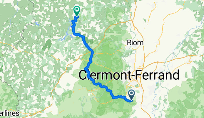
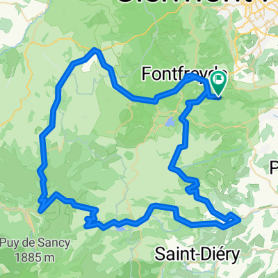
De Route d'Opme 8, Chanonat à Garachons, Sauret-Besserve
A cycling route starting in Chanonat, Auvergne-Rhône-Alpes, France.
Overview
About this route
- -:--
- Duration
- 60.9 km
- Distance
- 1,121 m
- Ascent
- 1,169 m
- Descent
- ---
- Avg. speed
- ---
- Max. altitude

Route quality
Waytypes & surfaces along the route
Waytypes
Road
38.4 km
(63 %)
Quiet road
8.5 km
(14 %)
Surfaces
Paved
12.2 km
(20 %)
Unpaved
0.6 km
(1 %)
Asphalt
11.6 km
(19 %)
Paved (undefined)
0.6 km
(1 %)
Continue with Bikemap
Use, edit, or download this cycling route
You would like to ride De Route d'Opme 8, Chanonat à Garachons, Sauret-Besserve or customize it for your own trip? Here is what you can do with this Bikemap route:
Free features
- Save this route as favorite or in collections
- Copy & plan your own version of this route
- Sync your route with Garmin or Wahoo
Premium features
Free trial for 3 days, or one-time payment. More about Bikemap Premium.
- Navigate this route on iOS & Android
- Export a GPX / KML file of this route
- Create your custom printout (try it for free)
- Download this route for offline navigation
Discover more Premium features.
Get Bikemap PremiumFrom our community
Other popular routes starting in Chanonat
 cap d agde chez yoyo
- Distance
- 371.5 km
- Ascent
- 3,198 m
- Descent
- 3,723 m
- Location
- Chanonat, Auvergne-Rhône-Alpes, France
 Orcival, Col d.. Morand, St. Nectaire
- Distance
- 95.7 km
- Ascent
- 1,615 m
- Descent
- 1,615 m
- Location
- Chanonat, Auvergne-Rhône-Alpes, France
 De Rue de la Condamine 9, Chanonat à Le Village, Monestier
- Distance
- 206.8 km
- Ascent
- 3,673 m
- Descent
- 3,375 m
- Location
- Chanonat, Auvergne-Rhône-Alpes, France
 chanonat vanosc
- Distance
- 172.4 km
- Ascent
- 2,333 m
- Descent
- 2,203 m
- Location
- Chanonat, Auvergne-Rhône-Alpes, France
 Testroute
- Distance
- 30 km
- Ascent
- 566 m
- Descent
- 566 m
- Location
- Chanonat, Auvergne-Rhône-Alpes, France
 De Route des Chevaliers de Malte 14, Chanonat à Route des Chevaliers de Malte 16, Chanonat
- Distance
- 43.6 km
- Ascent
- 624 m
- Descent
- 624 m
- Location
- Chanonat, Auvergne-Rhône-Alpes, France
 Restful route in Chanonat
- Distance
- 37.2 km
- Ascent
- 1,209 m
- Descent
- 1,144 m
- Location
- Chanonat, Auvergne-Rhône-Alpes, France
 De Route d'Opme 8, Chanonat à Garachons, Sauret-Besserve
- Distance
- 60.9 km
- Ascent
- 1,121 m
- Descent
- 1,169 m
- Location
- Chanonat, Auvergne-Rhône-Alpes, France
Open it in the app