

N°15:LeLacduPréduLaus (DépartRisoulStation)
A cycling route starting in Guillestre, Provence-Alpes-Côte d'Azur Region, France.
Overview
About this route
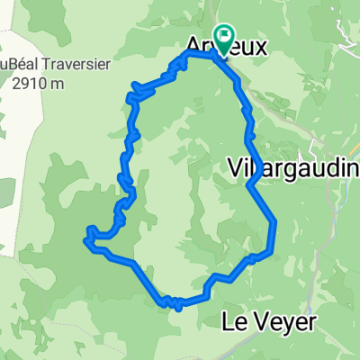
The departure is from the Risoul station, above the Tourist Office. 1- Take a left to follow the trail towards the Pré du Laus lake. It climbs a bit steeply at first, but you are quickly rewarded: the trail in the larch forest soon softens and descends to reach the lake. 2- Continue straight on the trail after the lake until the shelter located between the ridges of Martinat and Penon. 3- A magnificent landscape then unfolds with the Durance valley, the Embrunais, and even the Serre-Ponçon lake! The return is made by the same route to join the station.
CULTURAL: The Risoul Station
EDUCATIONAL: A fun and easy path for the whole family
FRIENDLY ATMOSPHERE: Picnic areas and fire spots around the Pré du Laus lake
- -:--
- Duration
- 9.2 km
- Distance
- 261 m
- Ascent
- 262 m
- Descent
- ---
- Avg. speed
- ---
- Max. altitude

Route quality
Waytypes & surfaces along the route
Waytypes
Track
7.6 km
(83 %)
Quiet road
1.1 km
(12 %)
Access road
0.5 km
(5 %)
Surfaces
Unpaved
4.6 km
(50 %)
Ground
4.4 km
(48 %)
Unpaved (undefined)
0.2 km
(2 %)
Undefined
4.6 km
(50 %)
Route highlights
Points of interest along the route
\"")
Point of interest after 0 km
La Station de ski Risoul 1850 est créée en 1971 sur les hauteurs de Risoul. La piste la plus haute se trouvant à 2457 mètres d'altitude. Aujourd’hui, la station accueille les skieurs en hiver et l'été, les pistes se transforment en alpages où bovins et ovins remplacent les sportifs !
\"")
Point of interest after 2.8 km
Lac du Pré du Laus
Continue with Bikemap
Use, edit, or download this cycling route
You would like to ride N°15:LeLacduPréduLaus (DépartRisoulStation) or customize it for your own trip? Here is what you can do with this Bikemap route:
Free features
- Save this route as favorite or in collections
- Copy & plan your own version of this route
- Sync your route with Garmin or Wahoo
Premium features
Free trial for 3 days, or one-time payment. More about Bikemap Premium.
- Navigate this route on iOS & Android
- Export a GPX / KML file of this route
- Create your custom printout (try it for free)
- Download this route for offline navigation
Discover more Premium features.
Get Bikemap PremiumFrom our community
Other popular routes starting in Guillestre
 N°15:LeLacduPréduLaus (DépartRisoulStation)
- Distance
- 9.2 km
- Ascent
- 261 m
- Descent
- 262 m
- Location
- Guillestre, Provence-Alpes-Côte d'Azur Region, France
 Route 12 im MTB (VTT) Führer von Guillestre
- Distance
- 22.2 km
- Ascent
- 1,004 m
- Descent
- 1,004 m
- Location
- Guillestre, Provence-Alpes-Côte d'Azur Region, France
 Route 12 im MTB (VTT) Führer von Guillestre
- Distance
- 22.3 km
- Ascent
- 996 m
- Descent
- 996 m
- Location
- Guillestre, Provence-Alpes-Côte d'Azur Region, France
 CeillacRiailleCristillan
- Distance
- 62.4 km
- Ascent
- 1,624 m
- Descent
- 1,624 m
- Location
- Guillestre, Provence-Alpes-Côte d'Azur Region, France
 CeillacRiailleCristillan(DuChalet)
- Distance
- 51.2 km
- Ascent
- 1,937 m
- Descent
- 1,936 m
- Location
- Guillestre, Provence-Alpes-Côte d'Azur Region, France
 LesGorgesduGuil
- Distance
- 17.9 km
- Ascent
- 481 m
- Descent
- 479 m
- Location
- Guillestre, Provence-Alpes-Côte d'Azur Region, France
 018 - 2014
- Distance
- 77.7 km
- Ascent
- 1,637 m
- Descent
- 2,039 m
- Location
- Guillestre, Provence-Alpes-Côte d'Azur Region, France
 Tour de Furfande
- Distance
- 23 km
- Ascent
- 1,077 m
- Descent
- 1,077 m
- Location
- Guillestre, Provence-Alpes-Côte d'Azur Region, France
Open it in the app