
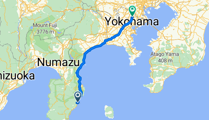
971-21, Naramoto, Higashiizu-Cho, Kamo-Gun to Hiyoshihoncho 1-Chōme, Kohoku-Ku, Yokohama-Shi
A cycling route starting in Itō, Shizuoka, Japan.
Overview
About this route
- 7 h 51 min
- Duration
- 137.1 km
- Distance
- 2,640 m
- Ascent
- 2,655 m
- Descent
- 17.5 km/h
- Avg. speed
- ---
- Max. altitude
Route quality
Waytypes & surfaces along the route
Waytypes
Quiet road
69.9 km
(51 %)
Road
41.1 km
(30 %)
Surfaces
Paved
42.5 km
(31 %)
Paved (undefined)
23.3 km
(17 %)
Asphalt
19.2 km
(14 %)
Undefined
94.6 km
(69 %)
Continue with Bikemap
Use, edit, or download this cycling route
You would like to ride 971-21, Naramoto, Higashiizu-Cho, Kamo-Gun to Hiyoshihoncho 1-Chōme, Kohoku-Ku, Yokohama-Shi or customize it for your own trip? Here is what you can do with this Bikemap route:
Free features
- Save this route as favorite or in collections
- Copy & plan your own version of this route
- Split it into stages to create a multi-day tour
- Sync your route with Garmin or Wahoo
Premium features
Free trial for 3 days, or one-time payment. More about Bikemap Premium.
- Navigate this route on iOS & Android
- Export a GPX / KML file of this route
- Create your custom printout (try it for free)
- Download this route for offline navigation
Discover more Premium features.
Get Bikemap PremiumFrom our community
Other popular routes starting in Itō
 Shuzenji > Numazu
- Distance
- 23.8 km
- Ascent
- 60 m
- Descent
- 116 m
- Location
- Itō, Shizuoka, Japan
 Ito to Shimoda
- Distance
- 53.7 km
- Ascent
- 687 m
- Descent
- 684 m
- Location
- Itō, Shizuoka, Japan
 修善寺駅, 伊豆市 to 修善寺駅, 伊豆市
- Distance
- 42.6 km
- Ascent
- 2,175 m
- Descent
- 2,175 m
- Location
- Itō, Shizuoka, Japan
 2022GW Trip Day 2
- Distance
- 113.6 km
- Ascent
- 2,535 m
- Descent
- 2,626 m
- Location
- Itō, Shizuoka, Japan
 IZU - Japan Cycle Sport circuiit
- Distance
- 12.3 km
- Ascent
- 356 m
- Descent
- 355 m
- Location
- Itō, Shizuoka, Japan
 05 - Izu Japan Cycling Sport Center km 146,4
- Distance
- 12.3 km
- Ascent
- 353 m
- Descent
- 353 m
- Location
- Itō, Shizuoka, Japan
 izu : Ito a shuzenji par cascade et Onsen
- Distance
- 32.5 km
- Ascent
- 597 m
- Descent
- 559 m
- Location
- Itō, Shizuoka, Japan
 伊豆高原駅, 伊東市 to 伊東市
- Distance
- 15.2 km
- Ascent
- 530 m
- Descent
- 521 m
- Location
- Itō, Shizuoka, Japan
Open it in the app