

Ilm-Tour
A cycling route starting in Kirchheim, Thuringia, Germany.
Overview
About this route
Vorbei am Stausee
- -:--
- Duration
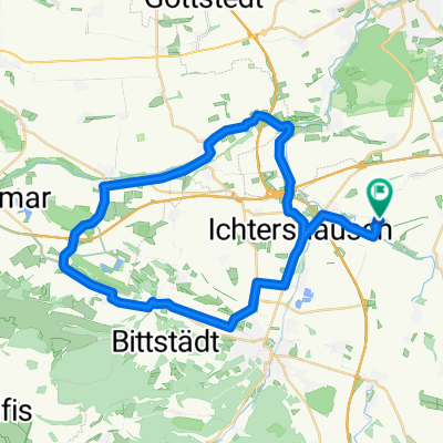
- 47.8 km
- Distance
- 395 m
- Ascent
- 385 m
- Descent
- ---
- Avg. speed
- 436 m
- Max. altitude
Route quality
Waytypes & surfaces along the route
Waytypes
Busy road
25.6 km
(53 %)
Road
12 km
(25 %)
Surfaces
Paved
42.9 km
(90 %)
Unpaved
1 km
(2 %)
Asphalt
42 km
(88 %)
Paved (undefined)
0.8 km
(2 %)
Continue with Bikemap
Use, edit, or download this cycling route
You would like to ride Ilm-Tour or customize it for your own trip? Here is what you can do with this Bikemap route:
Free features
- Save this route as favorite or in collections
- Copy & plan your own version of this route
- Sync your route with Garmin or Wahoo
Premium features
Free trial for 3 days, or one-time payment. More about Bikemap Premium.
- Navigate this route on iOS & Android
- Export a GPX / KML file of this route
- Create your custom printout (try it for free)
- Download this route for offline navigation
Discover more Premium features.
Get Bikemap PremiumFrom our community
Other popular routes starting in Kirchheim
 Kircheim-Wachsenburg-and return
- Distance
- 42.9 km
- Ascent
- 225 m
- Descent
- 230 m
- Location
- Kirchheim, Thuringia, Germany
 Arnstädter Straße 50, Amt Wachsenburg nach Gera-Radweg, Geratal
- Distance
- 25.6 km
- Ascent
- 265 m
- Descent
- 59 m
- Location
- Kirchheim, Thuringia, Germany
 Kirchweg 19, Kirchheim nach Kirchweg 19, Kirchheim
- Distance
- 61.2 km
- Ascent
- 881 m
- Descent
- 882 m
- Location
- Kirchheim, Thuringia, Germany
 Mit der Apple Watch um 30. Juli, 18:33 aufgenommen
- Distance
- 44.9 km
- Ascent
- 254 m
- Descent
- 254 m
- Location
- Kirchheim, Thuringia, Germany
 Kirchweg 18, Kirchheim nach Kirchweg 19, Kirchheim
- Distance
- 15.6 km
- Ascent
- 99 m
- Descent
- 101 m
- Location
- Kirchheim, Thuringia, Germany
 Kirchheim-Wechmar-Kirchheim
- Distance
- 52.4 km
- Ascent
- 170 m
- Descent
- 161 m
- Location
- Kirchheim, Thuringia, Germany
 Kirchheim - Neuhaus am Rennweg
- Distance
- 64.6 km
- Ascent
- 975 m
- Descent
- 425 m
- Location
- Kirchheim, Thuringia, Germany
 Kirchheim-Erfurter Zoopark-Kirchheim
- Distance
- 84.8 km
- Ascent
- 327 m
- Descent
- 283 m
- Location
- Kirchheim, Thuringia, Germany
Open it in the app