

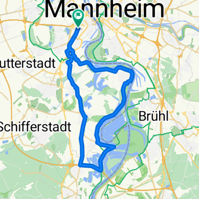
Tour Ludwigshafen - Monsheim
A cycling route starting in Ludwigshafen am Rhein, Rhineland-Palatinate, Germany.
Overview
About this route
- 1 h 33 min
- Duration
- 29.2 km
- Distance
- 135 m
- Ascent
- 94 m
- Descent
- 18.9 km/h
- Avg. speed
- ---
- Max. altitude

Route quality
Waytypes & surfaces along the route
Waytypes
Path
8.9 km
(31 %)
Road
6.6 km
(23 %)
Surfaces
Paved
21.3 km
(73 %)
Unpaved
1.5 km
(5 %)
Asphalt
15 km
(51 %)
Paving stones
2.7 km
(9 %)
Continue with Bikemap
Use, edit, or download this cycling route
You would like to ride Tour Ludwigshafen - Monsheim or customize it for your own trip? Here is what you can do with this Bikemap route:
Free features
- Save this route as favorite or in collections
- Copy & plan your own version of this route
- Sync your route with Garmin or Wahoo
Premium features
Free trial for 3 days, or one-time payment. More about Bikemap Premium.
- Navigate this route on iOS & Android
- Export a GPX / KML file of this route
- Create your custom printout (try it for free)
- Download this route for offline navigation
Discover more Premium features.
Get Bikemap PremiumFrom our community
Other popular routes starting in Ludwigshafen am Rhein
 ADFC Mannheim So,12.07.2009
- Distance
- 87.7 km
- Ascent
- 326 m
- Descent
- 323 m
- Location
- Ludwigshafen am Rhein, Rhineland-Palatinate, Germany
 Ludwigshafener Trainingsrunde
- Distance
- 41.2 km
- Ascent
- 63 m
- Descent
- 64 m
- Location
- Ludwigshafen am Rhein, Rhineland-Palatinate, Germany
 Rheinradweg Sandbachroute Schwarzwaldhochstraße
- Distance
- 157.2 km
- Ascent
- 829 m
- Descent
- 79 m
- Location
- Ludwigshafen am Rhein, Rhineland-Palatinate, Germany
 BASF Radtour 2011
- Distance
- 159.1 km
- Ascent
- 667 m
- Descent
- 668 m
- Location
- Ludwigshafen am Rhein, Rhineland-Palatinate, Germany
 LU-Kalmit-LU
- Distance
- 97.5 km
- Ascent
- 688 m
- Descent
- 694 m
- Location
- Ludwigshafen am Rhein, Rhineland-Palatinate, Germany
 Von Mannheim bis Landau in der Pfalz
- Distance
- 67.9 km
- Ascent
- 223 m
- Descent
- 160 m
- Location
- Ludwigshafen am Rhein, Rhineland-Palatinate, Germany
 50 ziger Runde
- Distance
- 50.3 km
- Ascent
- 57 m
- Descent
- 57 m
- Location
- Ludwigshafen am Rhein, Rhineland-Palatinate, Germany
 CYCLING THE RHINE: Route 16A
- Distance
- 79 km
- Ascent
- 119 m
- Descent
- 112 m
- Location
- Ludwigshafen am Rhein, Rhineland-Palatinate, Germany
Open it in the app