
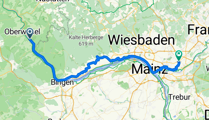
Riesling Radweg
A cycling route starting in Kaub, Rhineland-Palatinate, Germany.
Overview
About this route
Riesling Radweg
- -:--
- Duration
- 70.9 km
- Distance
- 407 m
- Ascent
- 338 m
- Descent
- ---
- Avg. speed
- ---
- Avg. speed

Route quality
Waytypes & surfaces along the route
Waytypes
Quiet road
25.6 km
(36 %)
Track
20.7 km
(29 %)
Surfaces
Paved
64.1 km
(90 %)
Unpaved
4.6 km
(6 %)
Asphalt
50.8 km
(72 %)
Concrete
6.1 km
(9 %)
Continue with Bikemap
Use, edit, or download this cycling route
You would like to ride Riesling Radweg or customize it for your own trip? Here is what you can do with this Bikemap route:
Free features
- Save this route as favorite or in collections
- Copy & plan your own version of this route
- Sync your route with Garmin or Wahoo
Premium features
Free trial for 3 days, or one-time payment. More about Bikemap Premium.
- Navigate this route on iOS & Android
- Export a GPX / KML file of this route
- Create your custom printout (try it for free)
- Download this route for offline navigation
Discover more Premium features.
Get Bikemap PremiumFrom our community
Other popular routes starting in Kaub
 Etappe 2
- Distance
- 10 km
- Ascent
- 227 m
- Descent
- 258 m
- Location
- Kaub, Rhineland-Palatinate, Germany
 Etape 22: Kaub - Koblenz
- Distance
- 47.6 km
- Ascent
- 269 m
- Descent
- 280 m
- Location
- Kaub, Rhineland-Palatinate, Germany
 Rheinsteig von St Goar nach Kaub
- Distance
- 30.6 km
- Ascent
- 748 m
- Descent
- 615 m
- Location
- Kaub, Rhineland-Palatinate, Germany
 Rn3 Oberwesel to Koblenz
- Distance
- 52.6 km
- Ascent
- 296 m
- Descent
- 253 m
- Location
- Kaub, Rhineland-Palatinate, Germany
 Morgenbachtal
- Distance
- 48 km
- Ascent
- 774 m
- Descent
- 775 m
- Location
- Kaub, Rhineland-Palatinate, Germany
 Riesling Radweg
- Distance
- 70.9 km
- Ascent
- 407 m
- Descent
- 338 m
- Location
- Kaub, Rhineland-Palatinate, Germany
 Dickies Loreley Rundfahrt
- Distance
- 56.6 km
- Ascent
- 417 m
- Descent
- 417 m
- Location
- Kaub, Rhineland-Palatinate, Germany
 Kaub-Sankt Goarshausen Wandern.gpx
- Distance
- 18.2 km
- Ascent
- 629 m
- Descent
- 627 m
- Location
- Kaub, Rhineland-Palatinate, Germany
Open it in the app