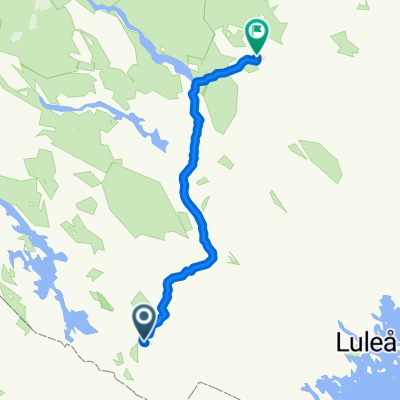
Arvidsjaur-Moskosel-Arvidsjaur (Straßenrad)
A cycling route starting in Arvidsjaur, Norrbotten County, Sweden.
Overview
About this route
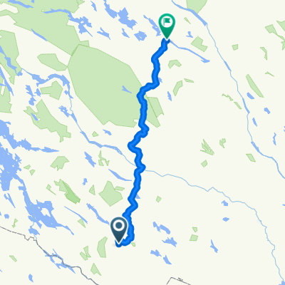
E45 is lightly trafficked... don't be afraid of this European route...! Hotel forecourt - turn right onto the main road turn right at the roundabout [45] heading towards Gällivare Moskosel 41 km total distance 2447m 376m above sea level go straight passing: town sign Rönneberget 17953m 508m above sea level go straight passing the railway crossing and town entrance Auktsjaur 5300m 404m above sea level go straight passing: junction to Stormyrheden 7000m 333m above sea level go straight passing: town sign Sleng 3300m 368m above sea level go straight passing: town sign Abmohed 5600m 333m above sea level turn left: Bergnäs Suddesjaur 1500m 333m above sea level turn left: Stationsvägen to the railway museum with services 1800m 335m above sea level return as above 44900m total: 89800m optional: a tour with the Inlandsbanan railway
- -:--
- Duration
- 45.1 km
- Distance
- 261 m
- Ascent
- 330 m
- Descent
- ---
- Avg. speed
- ---
- Max. altitude
Route highlights
Points of interest along the route
Point of interest after 0 km
Start vor dem Hotell-Laponia.se
Continue with Bikemap
Use, edit, or download this cycling route
You would like to ride Arvidsjaur-Moskosel-Arvidsjaur (Straßenrad) or customize it for your own trip? Here is what you can do with this Bikemap route:
Free features
- Save this route as favorite or in collections
- Copy & plan your own version of this route
- Sync your route with Garmin or Wahoo
Premium features
Free trial for 3 days, or one-time payment. More about Bikemap Premium.
- Navigate this route on iOS & Android
- Export a GPX / KML file of this route
- Create your custom printout (try it for free)
- Download this route for offline navigation
Discover more Premium features.
Get Bikemap PremiumFrom our community
Other popular routes starting in Arvidsjaur
- Ringvägen-Tour
- Distance
- 32.7 km
- Ascent
- 336 m
- Descent
- 291 m
- Location
- Arvidsjaur, Norrbotten County, Sweden
- S Arvidsjaur Vuollejaur_Medium
- Distance
- 43.3 km
- Ascent
- 172 m
- Descent
- 174 m
- Location
- Arvidsjaur, Norrbotten County, Sweden
- große Vittjakk-Runde
- Distance
- 25.1 km
- Ascent
- 478 m
- Descent
- 480 m
- Location
- Arvidsjaur, Norrbotten County, Sweden
- S Arvidsjaur Bergmyrberget Large
- Distance
- 39.5 km
- Ascent
- 170 m
- Descent
- 167 m
- Location
- Arvidsjaur, Norrbotten County, Sweden
- Arvidsjaur-Bike-Train-Combination (Inlandsbahn)
- Distance
- 114.1 km
- Ascent
- 616 m
- Descent
- 616 m
- Location
- Arvidsjaur, Norrbotten County, Sweden
- Rentier-Tour
- Distance
- 33.4 km
- Ascent
- 409 m
- Descent
- 355 m
- Location
- Arvidsjaur, Norrbotten County, Sweden
- Arvidsjaur-Moskosel-Arvidsjaur (Straßenrad)
- Distance
- 45.1 km
- Ascent
- 261 m
- Descent
- 330 m
- Location
- Arvidsjaur, Norrbotten County, Sweden
- Grosse Mittsommertour
- Distance
- 55.1 km
- Ascent
- 454 m
- Descent
- 454 m
- Location
- Arvidsjaur, Norrbotten County, Sweden
Open it in the app