

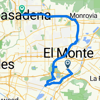
50 mile route
A cycling route starting in South El Monte, California, United States.
Overview
About this route
- 4 h 36 min
- Duration
- 81.8 km
- Distance
- 412 m
- Ascent
- 413 m
- Descent
- 17.8 km/h
- Avg. speed
- ---
- Max. altitude

Route quality
Waytypes & surfaces along the route
Waytypes
Cycleway
67.1 km
(82 %)
Road
4.9 km
(6 %)
Surfaces
Paved
54.8 km
(67 %)
Paved (undefined)
50.7 km
(62 %)
Asphalt
2.5 km
(3 %)
Continue with Bikemap
Use, edit, or download this cycling route
You would like to ride 50 mile route or customize it for your own trip? Here is what you can do with this Bikemap route:
Free features
- Save this route as favorite or in collections
- Copy & plan your own version of this route
- Split it into stages to create a multi-day tour
- Sync your route with Garmin or Wahoo
Premium features
Free trial for 3 days, or one-time payment. More about Bikemap Premium.
- Navigate this route on iOS & Android
- Export a GPX / KML file of this route
- Create your custom printout (try it for free)
- Download this route for offline navigation
Discover more Premium features.
Get Bikemap PremiumFrom our community
Other popular routes starting in South El Monte
 Sporty route in Pasadena
- Distance
- 43.4 km
- Ascent
- 235 m
- Descent
- 250 m
- Location
- South El Monte, California, United States
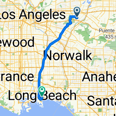
 whittier narrows to seal beach 43.86 miles
- Distance
- 70.6 km
- Ascent
- 293 m
- Descent
- 296 m
- Location
- South El Monte, California, United States
 Joel’s rides
- Distance
- 75.9 km
- Ascent
- 111 m
- Descent
- 111 m
- Location
- South El Monte, California, United States
 Recovered Route
- Distance
- 32.1 km
- Ascent
- 111 m
- Descent
- 92 m
- Location
- South El Monte, California, United States
 600 Rosemead Blvd, South El Monte to 600 Rosemead Blvd, South El Monte
- Distance
- 3 km
- Ascent
- 0 m
- Descent
- 0 m
- Location
- South El Monte, California, United States
 Blistering ride in Long Beach
- Distance
- 44.6 km
- Ascent
- 129 m
- Descent
- 204 m
- Location
- South El Monte, California, United States
 High-speed route in South El Monte
- Distance
- 9 km
- Ascent
- 35 m
- Descent
- 89 m
- Location
- South El Monte, California, United States
 studio to TC
- Distance
- 7.3 km
- Ascent
- 36 m
- Descent
- 4 m
- Location
- South El Monte, California, United States
Open it in the app