
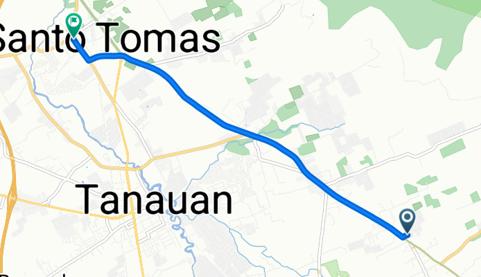
Pan-Philippine Highway, Santo Tomas to General Malvar Avenue 32, Santo Tomas
A cycling route starting in Tanauan, Calabarzon, Philippines.
Overview
About this route
- -:--
- Duration
- 6.3 km
- Distance
- 21 m
- Ascent
- 79 m
- Descent
- ---
- Avg. speed
- ---
- Max. altitude

Route quality
Waytypes & surfaces along the route
Waytypes
Cycleway
4.1 km
(65 %)
Quiet road
1.3 km
(21 %)
Surfaces
Paved
5 km
(80 %)
Asphalt
4.6 km
(74 %)
Concrete
0.4 km
(6 %)
Undefined
1.3 km
(20 %)
Continue with Bikemap
Use, edit, or download this cycling route
You would like to ride Pan-Philippine Highway, Santo Tomas to General Malvar Avenue 32, Santo Tomas or customize it for your own trip? Here is what you can do with this Bikemap route:
Free features
- Save this route as favorite or in collections
- Copy & plan your own version of this route
- Sync your route with Garmin or Wahoo
Premium features
Free trial for 3 days, or one-time payment. More about Bikemap Premium.
- Navigate this route on iOS & Android
- Export a GPX / KML file of this route
- Create your custom printout (try it for free)
- Download this route for offline navigation
Discover more Premium features.
Get Bikemap PremiumFrom our community
Other popular routes starting in Tanauan
 taal loop with taal church
- Distance
- 120 km
- Ascent
- 1,307 m
- Descent
- 1,307 m
- Location
- Tanauan, Calabarzon, Philippines
 Relaxed route in Biñan
- Distance
- 40.7 km
- Ascent
- 1,736 m
- Descent
- 1,878 m
- Location
- Tanauan, Calabarzon, Philippines
 Route from San Pedro to San Pablo City
- Distance
- 29.3 km
- Ascent
- 179 m
- Descent
- 259 m
- Location
- Tanauan, Calabarzon, Philippines
 Tagaytay-Tanauan Ride
- Distance
- 70 km
- Ascent
- 1,393 m
- Descent
- 1,393 m
- Location
- Tanauan, Calabarzon, Philippines
 Pan-Philippine Highway 22, Santo Tomas to Chamomile Loop, Tanauan
- Distance
- 14.9 km
- Ascent
- 130 m
- Descent
- 116 m
- Location
- Tanauan, Calabarzon, Philippines
 laguna loop
- Distance
- 201.4 km
- Ascent
- 733 m
- Descent
- 694 m
- Location
- Tanauan, Calabarzon, Philippines
 taal loop
- Distance
- 118 km
- Ascent
- 1,659 m
- Descent
- 1,660 m
- Location
- Tanauan, Calabarzon, Philippines
 Route from President Jose P. Laurel Highway 17, Tanauan
- Distance
- 62.1 km
- Ascent
- 871 m
- Descent
- 730 m
- Location
- Tanauan, Calabarzon, Philippines
Open it in the app