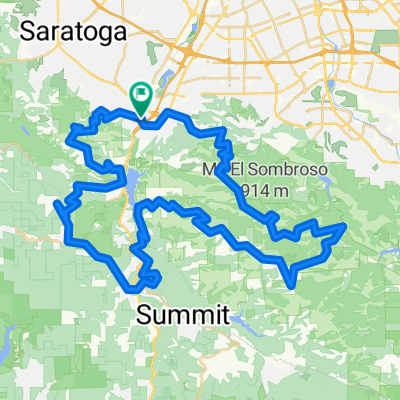
Limekiln / Preist Rock Loop
A cycling route starting in Los Gatos, California, United States.
Overview
About this route
- -:--
- Duration
- 19 km
- Distance
- 785 m
- Ascent
- 786 m
- Descent
- ---
- Avg. speed
- ---
- Max. altitude
Route quality
Waytypes & surfaces along the route
Waytypes
Track
13.3 km
(70 %)
Path
3.2 km
(17 %)
Surfaces
Unpaved
16.5 km
(87 %)
Ground
14.6 km
(77 %)
Unpaved (undefined)
1.9 km
(10 %)
Undefined
2.5 km
(13 %)
Continue with Bikemap
Use, edit, or download this cycling route
You would like to ride Limekiln / Preist Rock Loop or customize it for your own trip? Here is what you can do with this Bikemap route:
Free features
- Save this route as favorite or in collections
- Copy & plan your own version of this route
- Sync your route with Garmin or Wahoo
Premium features
Free trial for 3 days, or one-time payment. More about Bikemap Premium.
- Navigate this route on iOS & Android
- Export a GPX / KML file of this route
- Create your custom printout (try it for free)
- Download this route for offline navigation
Discover more Premium features.
Get Bikemap PremiumFrom our community
Other popular routes starting in Los Gatos
Los Gatos- Distance
- 8.9 km
- Ascent
- 930 m
- Descent
- 930 m
- Location
- Los Gatos, California, United States
los gatos 1- Distance
- 15.7 km
- Ascent
- 384 m
- Descent
- 277 m
- Location
- Los Gatos, California, United States
Limekiln train- Distance
- 17.9 km
- Ascent
- 815 m
- Descent
- 812 m
- Location
- Los Gatos, California, United States
Shannon Kennedy- Distance
- 13.4 km
- Ascent
- 277 m
- Descent
- 267 m
- Location
- Los Gatos, California, United States
Limekiln / Preist Rock Loop- Distance
- 19 km
- Ascent
- 785 m
- Descent
- 786 m
- Location
- Los Gatos, California, United States
Los Gatos - Santa Cruz- Distance
- 109.2 km
- Ascent
- 1,445 m
- Descent
- 1,445 m
- Location
- Los Gatos, California, United States
lexington reservoir- Distance
- 12.4 km
- Ascent
- 253 m
- Descent
- 253 m
- Location
- Los Gatos, California, United States
Campbell Loop- Distance
- 34.6 km
- Ascent
- 237 m
- Descent
- 235 m
- Location
- Los Gatos, California, United States
Open it in the app

