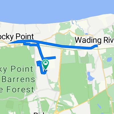
Wading River-Calverton (Mill Rd)
A cycling route starting in East Shoreham, New York, United States of America.
Overview
About this route
N. Country Rd. - Wading River Manor Rd. - Mill RdEdward Ave
- -:--
- Duration
- 35.2 km
- Distance
- 133 m
- Ascent
- 133 m
- Descent
- ---
- Avg. speed
- ---
- Avg. speed
Route quality
Waytypes & surfaces along the route
Waytypes
Busy road
18.9 km
(54 %)
Road
10.4 km
(29 %)
Surfaces
Paved
0.6 km
(2 %)
Unpaved
0.3 km
(<1 %)
Asphalt
0.6 km
(2 %)
Unpaved (undefined)
0.3 km
(<1 %)
Undefined
34.4 km
(98 %)
Continue with Bikemap
Use, edit, or download this cycling route
You would like to ride Wading River-Calverton (Mill Rd) or customize it for your own trip? Here is what you can do with this Bikemap route:
Free features
- Save this route as favorite or in collections
- Copy & plan your own version of this route
- Sync your route with Garmin or Wahoo
Premium features
Free trial for 3 days, or one-time payment. More about Bikemap Premium.
- Navigate this route on iOS & Android
- Export a GPX / KML file of this route
- Create your custom printout (try it for free)
- Download this route for offline navigation
Discover more Premium features.
Get Bikemap PremiumFrom our community
Other popular routes starting in East Shoreham
- Wading River-Calverton (Mill Rd) v2
- Distance
- 36.8 km
- Ascent
- 185 m
- Descent
- 185 m
- Location
- East Shoreham, New York, United States of America
- Smith Point
- Distance
- 69.8 km
- Ascent
- 126 m
- Descent
- 126 m
- Location
- East Shoreham, New York, United States of America
- Wading River-Calverton (River Rd)
- Distance
- 31.9 km
- Ascent
- 158 m
- Descent
- 160 m
- Location
- East Shoreham, New York, United States of America
- Wading River-Calverton (Mill Rd)
- Distance
- 35.2 km
- Ascent
- 133 m
- Descent
- 133 m
- Location
- East Shoreham, New York, United States of America
- WR - Yaphank (Whiskey)
- Distance
- 45.4 km
- Ascent
- 108 m
- Descent
- 111 m
- Location
- East Shoreham, New York, United States of America
- Shoreham-Baiting Hollow (Rt. 25 back)
- Distance
- 35.1 km
- Ascent
- 166 m
- Descent
- 166 m
- Location
- East Shoreham, New York, United States of America
- Glen Dr, Ridge to Glen Dr, Ridge
- Distance
- 32.7 km
- Ascent
- 115 m
- Descent
- 114 m
- Location
- East Shoreham, New York, United States of America
- Flanders Big Duck
- Distance
- 58.5 km
- Ascent
- 138 m
- Descent
- 138 m
- Location
- East Shoreham, New York, United States of America
Open it in the app