

MBM
Robinson-Canal-Chimborazo-Leigh-Scotts-
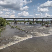
A cycling route starting in Richmond, Virginia, United States.
Overview
About this route
Robinson -Grayland Ave - Idlewood Ave - East Byrd - 2nd St - Tredegar St - S.7th St - Canal Walk - 21nd St - E. Marshall St - N. 32nd - Chimborazo - N. 32nd St - E. Leigh St. - Prncess Ave. - Mosby St. - O St / Viaduct - W. Leigh St. - Moore St. - Roseneath - Kensington - Robinson 12.4miles
- -:--
- Duration
- 20.3 km
- Distance
- 109 m
- Ascent
- 110 m
- Descent
- ---
- Avg. speed
- ---
- Max. altitude

Part of
4 stages
Route quality
Waytypes & surfaces along the route
Waytypes
Quiet road
8.1 km
(40 %)
Road
6.5 km
(32 %)
Surfaces
Paved
10.6 km
(52 %)
Unpaved
0.2 km
(1 %)
Asphalt
7.3 km
(36 %)
Paved (undefined)
2.4 km
(12 %)
Continue with Bikemap
Use, edit, or download this cycling route
You would like to ride Robinson-Canal-Chimborazo-Leigh-Scotts- or customize it for your own trip? Here is what you can do with this Bikemap route:
Free features
- Save this route as favorite or in collections
- Copy & plan your own version of this route
- Sync your route with Garmin or Wahoo
Premium features
Free trial for 3 days, or one-time payment. More about Bikemap Premium.
- Navigate this route on iOS & Android
- Export a GPX / KML file of this route
- Create your custom printout (try it for free)
- Download this route for offline navigation
Discover more Premium features.
Get Bikemap PremiumFrom our community
Other popular routes starting in Richmond
 Forest Hill Avenue 4200, Richmond to Forest Hill Avenue 4200, Richmond Touring
- Distance
- 31.6 km
- Ascent
- 328 m
- Descent
- 327 m
- Location
- Richmond, Virginia, United States
 Flood wall As Heck
- Distance
- 11.6 km
- Ascent
- 117 m
- Descent
- 116 m
- Location
- Richmond, Virginia, United States
 Quick Ride
- Distance
- 6.4 km
- Ascent
- 54 m
- Descent
- 54 m
- Location
- Richmond, Virginia, United States
 Conquer the Cobbles
- Distance
- 16.5 km
- Ascent
- 159 m
- Descent
- 158 m
- Location
- Richmond, Virginia, United States
 BLACK RESTAURANT BREEZE RIDE
- Distance
- 20.4 km
- Ascent
- 56 m
- Descent
- 56 m
- Location
- Richmond, Virginia, United States
 williamsburg
- Distance
- 87.5 km
- Ascent
- 208 m
- Descent
- 193 m
- Location
- Richmond, Virginia, United States
 Byrd Park River Loop To U Of R And Back
- Distance
- 30.7 km
- Ascent
- 218 m
- Descent
- 216 m
- Location
- Richmond, Virginia, United States
 Rob-Herm-Belle-Seminary-Walton-Northside-Main
- Distance
- 18.2 km
- Ascent
- 85 m
- Descent
- 84 m
- Location
- Richmond, Virginia, United States
Open it in the app