
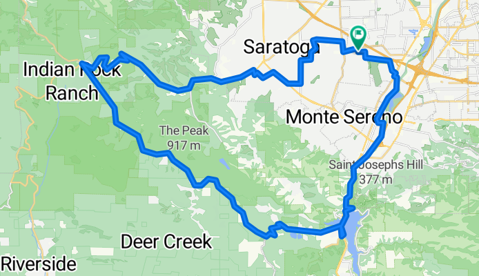
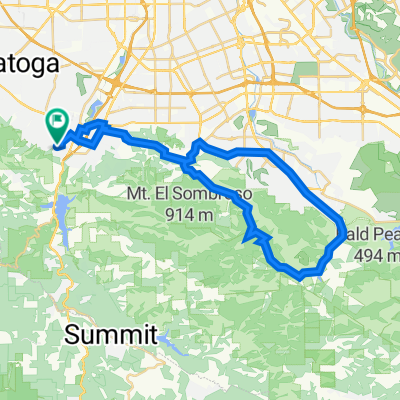
creekTrail_upBlack,Gist->Skyline, north->9 &down
A cycling route starting in Monte Sereno, California, United States of America.
Overview
About this route
- -:--
- Duration
- 48.9 km
- Distance
- 933 m
- Ascent
- 936 m
- Descent
- ---
- Avg. speed
- ---
- Max. altitude
Continue with Bikemap
Use, edit, or download this cycling route
You would like to ride creekTrail_upBlack,Gist->Skyline, north->9 &down or customize it for your own trip? Here is what you can do with this Bikemap route:
Free features
- Save this route as favorite or in collections
- Copy & plan your own version of this route
- Sync your route with Garmin or Wahoo
Premium features
Free trial for 3 days, or one-time payment. More about Bikemap Premium.
- Navigate this route on iOS & Android
- Export a GPX / KML file of this route
- Create your custom printout (try it for free)
- Download this route for offline navigation
Discover more Premium features.
Get Bikemap PremiumFrom our community
Other popular routes starting in Monte Sereno
 41 Manzanita Ave, Los Gatos to 41 Manzanita Ave, Los Gatos
- Distance
- 45.1 km
- Ascent
- 774 m
- Descent
- 773 m
- Location
- Monte Sereno, California, United States of America
 creekTrail_upBlack,Gist->Skyline, north->9 &down
- Distance
- 48.9 km
- Ascent
- 933 m
- Descent
- 936 m
- Location
- Monte Sereno, California, United States of America
 41 Manzanita Ave, Los Gatos to 121 Laurel Ave, Los Gatos
- Distance
- 0.4 km
- Ascent
- 30 m
- Descent
- 14 m
- Location
- Monte Sereno, California, United States of America
 Aquinas Trail, Los Gatos to 16515 Marchmont Dr, Los Gatos
- Distance
- 19.5 km
- Ascent
- 469 m
- Descent
- 706 m
- Location
- Monte Sereno, California, United States of America
 Los Gatos - Pasatiempo Inn
- Distance
- 59.6 km
- Ascent
- 1,044 m
- Descent
- 998 m
- Location
- Monte Sereno, California, United States of America
 Tour de California -Day 1 - LGS to HMB
- Distance
- 72.1 km
- Ascent
- 1,056 m
- Descent
- 1,115 m
- Location
- Monte Sereno, California, United States of America
 Long ride through Los Gatos
- Distance
- 34.1 km
- Ascent
- 258 m
- Descent
- 258 m
- Location
- Monte Sereno, California, United States of America
 41 Manzanita Ave, Los Gatos to 41 Manzanita Ave, Los Gatos
- Distance
- 34.8 km
- Ascent
- 1,300 m
- Descent
- 1,300 m
- Location
- Monte Sereno, California, United States of America
Open it in the app