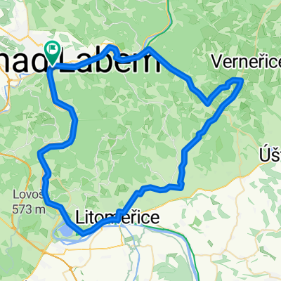
Rozhledna Náčkovice
A cycling route starting in Ústí nad Labem, Ústecký kraj, Czechia.
Overview
About this route
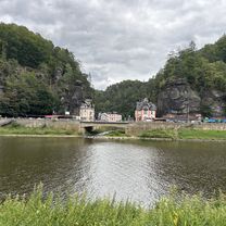
A nice route partially on a cycle path along the Elbe and through the hills under Bukovka. A loop from Ústí nad Labem through Zubrnice (open-air museum, historic railway), then uphill to Náčkovice, near which a newly built lookout tower stands. Then a beautiful descent down towards Litoměřice via Ploskovice (castle). In Litoměřice, you can see a nice large square with arcades, the town’s Gothic-Renaissance town hall, bastions above the city walls, and many other monuments. Back to Ústí on the cycle path along the Elbe via Žernoseky and Sebuzín.
- -:--
- Duration
- 67.4 km
- Distance
- 618 m
- Ascent
- 620 m
- Descent
- ---
- Avg. speed
- ---
- Max. altitude
Route quality
Waytypes & surfaces along the route
Waytypes
Road
16.8 km
(25 %)
Cycleway
12.8 km
(19 %)
Surfaces
Paved
21.6 km
(32 %)
Unpaved
0.7 km
(1 %)
Asphalt
21.6 km
(32 %)
Gravel
0.7 km
(1 %)
Undefined
45.2 km
(67 %)
Route highlights
Points of interest along the route

Photo after 16.6 km
Zubrnice skanzen

Photo after 23 km
Náčkovice - rozhledna

Photo after 36.5 km
Zámek Ploskovice

Photo after 43.9 km
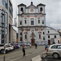
Stará radnice Litoměřice
Continue with Bikemap
Use, edit, or download this cycling route
You would like to ride Rozhledna Náčkovice or customize it for your own trip? Here is what you can do with this Bikemap route:
Free features
- Save this route as favorite or in collections
- Copy & plan your own version of this route
- Sync your route with Garmin or Wahoo
Premium features
Free trial for 3 days, or one-time payment. More about Bikemap Premium.
- Navigate this route on iOS & Android
- Export a GPX / KML file of this route
- Create your custom printout (try it for free)
- Download this route for offline navigation
Discover more Premium features.
Get Bikemap PremiumFrom our community
Other popular routes starting in Ústí nad Labem
KB-Bad Shandau und curyk- Distance
- 104.3 km
- Ascent
- 307 m
- Descent
- 305 m
- Location
- Ústí nad Labem, Ústecký kraj, Czechia
2017-01- Distance
- 30 km
- Ascent
- 527 m
- Descent
- 471 m
- Location
- Ústí nad Labem, Ústecký kraj, Czechia
Könnyű út- Distance
- 11.4 km
- Ascent
- 33 m
- Descent
- 46 m
- Location
- Ústí nad Labem, Ústecký kraj, Czechia
Severní čechy - Sachsen (foto)- Distance
- 162.3 km
- Ascent
- 2,946 m
- Descent
- 2,709 m
- Location
- Ústí nad Labem, Ústecký kraj, Czechia
Mírové náměstí, Ústí nad Labem nach Kirnitzschtalstraße, Bad Schandau- Distance
- 50.3 km
- Ascent
- 271 m
- Descent
- 287 m
- Location
- Ústí nad Labem, Ústecký kraj, Czechia
2017-09- Distance
- 27.9 km
- Ascent
- 620 m
- Descent
- 619 m
- Location
- Ústí nad Labem, Ústecký kraj, Czechia
Karla IV., Ústí nad Labem až Ke Hradu, Ústí nad Labem- Distance
- 59.5 km
- Ascent
- 1,642 m
- Descent
- 1,644 m
- Location
- Ústí nad Labem, Ústecký kraj, Czechia
2017-05- Distance
- 37.2 km
- Ascent
- 603 m
- Descent
- 604 m
- Location
- Ústí nad Labem, Ústecký kraj, Czechia
Open it in the app

