

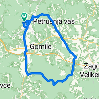
Route to Ljubljanska cesta 42
A cycling route starting in Ivančna Gorica, Občina Ivančna Gorica, Slovenia.
Overview
About this route
- 1 h 54 min
- Duration
- 28 km
- Distance
- 273 m
- Ascent
- 266 m
- Descent
- 14.7 km/h
- Avg. speed
- ---
- Max. altitude
Route quality
Waytypes & surfaces along the route
Waytypes
Quiet road
15.4 km
(55 %)
Access road
1.4 km
(5 %)
Surfaces
Paved
14 km
(50 %)
Unpaved
0.8 km
(3 %)
Asphalt
14 km
(50 %)
Gravel
0.8 km
(3 %)
Undefined
13.2 km
(47 %)
Continue with Bikemap
Use, edit, or download this cycling route
You would like to ride Route to Ljubljanska cesta 42 or customize it for your own trip? Here is what you can do with this Bikemap route:
Free features
- Save this route as favorite or in collections
- Copy & plan your own version of this route
- Sync your route with Garmin or Wahoo
Premium features
Free trial for 3 days, or one-time payment. More about Bikemap Premium.
- Navigate this route on iOS & Android
- Export a GPX / KML file of this route
- Create your custom printout (try it for free)
- Download this route for offline navigation
Discover more Premium features.
Get Bikemap PremiumFrom our community
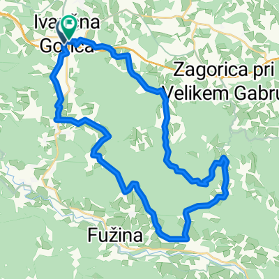
Other popular routes starting in Ivančna Gorica
 rdeči kal
- Distance
- 20 km
- Ascent
- 307 m
- Descent
- 307 m
- Location
- Ivančna Gorica, Občina Ivančna Gorica, Slovenia
 Suhokranjska
- Distance
- 32.3 km
- Ascent
- 671 m
- Descent
- 671 m
- Location
- Ivančna Gorica, Občina Ivančna Gorica, Slovenia
 Z MOTORJEM NAOKOLI
- Distance
- 375.3 km
- Ascent
- 6,643 m
- Descent
- 6,553 m
- Location
- Ivančna Gorica, Občina Ivančna Gorica, Slovenia
 Žuži - trebnje - (stranske ceste) hrastov dol
- Distance
- 57.6 km
- Ascent
- 440 m
- Descent
- 440 m
- Location
- Ivančna Gorica, Občina Ivančna Gorica, Slovenia
 gabrje - čatež
- Distance
- 41.3 km
- Ascent
- 589 m
- Descent
- 589 m
- Location
- Ivančna Gorica, Občina Ivančna Gorica, Slovenia
 Dolenjska - Žužemberk - Trebnje - Iv. Gorica
- Distance
- 55.3 km
- Ascent
- 345 m
- Descent
- 348 m
- Location
- Ivančna Gorica, Občina Ivančna Gorica, Slovenia
 gabrje - obolno - sela - gabrje
- Distance
- 18.4 km
- Ascent
- 488 m
- Descent
- 488 m
- Location
- Ivančna Gorica, Občina Ivančna Gorica, Slovenia
 Šentvid_preurejam_CLONED FROM ROUTE 864676
- Distance
- 64.2 km
- Ascent
- 836 m
- Descent
- 836 m
- Location
- Ivančna Gorica, Občina Ivančna Gorica, Slovenia
Open it in the app