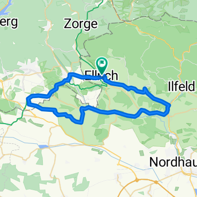
Ellrich - Rotesütte - Netzkater - Ilfeld...
A cycling route starting in Ellrich, Free State of Thuringia, Germany.
Overview
About this route
- 2 h 50 min
- Duration
- 37 km
- Distance
- 570 m
- Ascent
- 561 m
- Descent
- 13.1 km/h
- Avg. speed
- ---
- Avg. speed
Route quality
Waytypes & surfaces along the route
Waytypes
Busy road
18.5 km
(50 %)
Road
6.8 km
(18 %)
Surfaces
Paved
29 km
(78 %)
Unpaved
2.4 km
(7 %)
Asphalt
28.6 km
(77 %)
Gravel
1.4 km
(4 %)
Continue with Bikemap
Use, edit, or download this cycling route
You would like to ride Ellrich - Rotesütte - Netzkater - Ilfeld... or customize it for your own trip? Here is what you can do with this Bikemap route:
Free features
- Save this route as favorite or in collections
- Copy & plan your own version of this route
- Sync your route with Garmin or Wahoo
Premium features
Free trial for 3 days, or one-time payment. More about Bikemap Premium.
- Navigate this route on iOS & Android
- Export a GPX / KML file of this route
- Create your custom printout (try it for free)
- Download this route for offline navigation
Discover more Premium features.
Get Bikemap PremiumFrom our community
Other popular routes starting in Ellrich
- Entspannende Route in
- Distance
- 24.8 km
- Ascent
- 450 m
- Descent
- 240 m
- Location
- Ellrich, Free State of Thuringia, Germany
- Nachmittagsrunde 2
- Distance
- 35.1 km
- Ascent
- 273 m
- Descent
- 273 m
- Location
- Ellrich, Free State of Thuringia, Germany
- Tour 25 Görsbach
- Distance
- 65.1 km
- Ascent
- 163 m
- Descent
- 163 m
- Location
- Ellrich, Free State of Thuringia, Germany
- Ellrich - Hexentanzplatz
- Distance
- 6.3 km
- Ascent
- 115 m
- Descent
- 113 m
- Location
- Ellrich, Free State of Thuringia, Germany
- Grafschaftsrunde
- Distance
- 33 km
- Ascent
- 217 m
- Descent
- 214 m
- Location
- Ellrich, Free State of Thuringia, Germany
- Maitour
- Distance
- 36.2 km
- Ascent
- 243 m
- Descent
- 243 m
- Location
- Ellrich, Free State of Thuringia, Germany
- Trainingstour Sülzhayn-Hohe Strasse
- Distance
- 19.5 km
- Ascent
- 234 m
- Descent
- 230 m
- Location
- Ellrich, Free State of Thuringia, Germany
- Ellrich-Steina-Klettenberg zurück
- Distance
- 38.1 km
- Ascent
- 498 m
- Descent
- 500 m
- Location
- Ellrich, Free State of Thuringia, Germany
Open it in the app