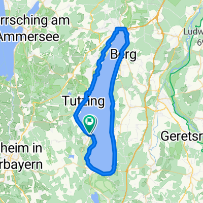
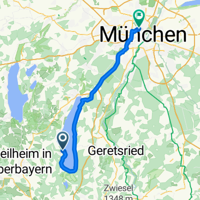
Auf den Spuren des Blauen Reiters
A cycling route starting in Bernried, Bavaria, Germany.
Overview
About this route
Upper Bavaria like from a picture book. Picturesque towns, beer gardens, baroque churches, Lüftlmalerei – a fascinating holiday experience against the majestic backdrop of the Bavarian Alps. Nowhere in Germany is there a landscape that connects art and nature enjoyment as intensely as between Munich and the Alpine foothills. Four museums await cyclists where they can gain a focused and high-quality overview of German Expressionism. Especially in the Alpine foothills, it is advisable to combine museum visits with impressive cycling tours. A bike tour in the footsteps of the ‘Blue Rider’ leads through the landscape that already inspired Franz Marc, Gabriele Münter, and Wassily Kandinsky.
- 8 h 34 min
- Duration
- 92.2 km
- Distance
- 716 m
- Ascent
- 720 m
- Descent
- 10.8 km/h
- Avg. speed
- ---
- Max. altitude
Route quality
Waytypes & surfaces along the route
Waytypes
Track
23.1 km
(25 %)
Quiet road
22.1 km
(24 %)
Surfaces
Paved
58.1 km
(63 %)
Unpaved
22.1 km
(24 %)
Asphalt
56.3 km
(61 %)
Gravel
14.8 km
(16 %)
Continue with Bikemap
Use, edit, or download this cycling route
You would like to ride Auf den Spuren des Blauen Reiters or customize it for your own trip? Here is what you can do with this Bikemap route:
Free features
- Save this route as favorite or in collections
- Copy & plan your own version of this route
- Split it into stages to create a multi-day tour
- Sync your route with Garmin or Wahoo
Premium features
Free trial for 3 days, or one-time payment. More about Bikemap Premium.
- Navigate this route on iOS & Android
- Export a GPX / KML file of this route
- Create your custom printout (try it for free)
- Download this route for offline navigation
Discover more Premium features.
Get Bikemap PremiumFrom our community
Other popular routes starting in Bernried
- Bahnhofstraße 25, Bernried am Starnberger See nach Bahnhofstraße 25, Bernried am Starnberger See
- Distance
- 56.9 km
- Ascent
- 531 m
- Descent
- 532 m
- Location
- Bernried, Bavaria, Germany
- Starnberger See Rundfahrt
- Distance
- 49.2 km
- Ascent
- 61 m
- Descent
- 49 m
- Location
- Bernried, Bavaria, Germany
- Bernried-Staffelsee-Riegsee H80
- Distance
- 65.5 km
- Ascent
- 667 m
- Descent
- 667 m
- Location
- Bernried, Bavaria, Germany
- Runde Starnbergersee ab Bernried H80-1
- Distance
- 59.7 km
- Ascent
- 515 m
- Descent
- 515 m
- Location
- Bernried, Bavaria, Germany
- Bernried-Walchensee-Bernried
- Distance
- 113.4 km
- Ascent
- 618 m
- Descent
- 618 m
- Location
- Bernried, Bavaria, Germany
- Auf den Spuren des Blauen Reiters
- Distance
- 92.2 km
- Ascent
- 716 m
- Descent
- 720 m
- Location
- Bernried, Bavaria, Germany
- Um den Ammersee ab Gasthaus Steidl
- Distance
- 71.9 km
- Ascent
- 496 m
- Descent
- 497 m
- Location
- Bernried, Bavaria, Germany
- Von Bernried um den Ammersee H80
- Distance
- 85.2 km
- Ascent
- 716 m
- Descent
- 716 m
- Location
- Bernried, Bavaria, Germany
Open it in the app